Special to The SunBreak by Arne Christensen
I recently looked at Seattle Chronicle, a DVD reprint of local historian Paul Dorpat’s 1992 VHS “2-hour tour through Seatle’s first ninety years, 1851 to 1941,” to quote the front copy.
It’s him narrating a roughly chronological slideshow, for the most part, of pictures of the city as it was a long time ago–some early ’90s video footage of the same neighborhoods contrasted with photographs of them in, say, 1872, to illuminate how much things have changed. Dorpat’s narration is smooth and accomplished: he knows what he’s talking about, and he knows how to talk about it.
The video is, inevitably, a little slow despite the background music: Still, if you’re interested in the way Seattle (especially downtown) used to be, or if your job requires you to know how the city used to be, watching Dorpat’s video is a very good and pretty fast way to get acquainted with old Seattle without looking through old newspapers, city archives, or a stack of books on Seattle history.
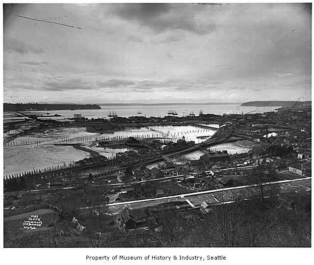
Dorpat doesn’t mention earthquakes once, but in several pictures I noticed how watery the SoDo area was well into the 20th century. It’s already been emphasized how much of the waterfront along the Viaduct is fill that used to be tidal flats, and Seattle Chronicle clearly shows that. (Along with watching Dorpat’s video, you can read about the history of SoDo by buying the book on SoDo brought out just last year by Dan Raley, formerly of the Seattle P-I.)
The pictures of SoDo show that the area beneath Beacon Hill also used to be tideflats. It was filled in somewhat by the 1930s, but in that decade the Port of Seattle held it as vacant land, which is why it became the site of Seattle’s Hooverville village of over 500 down-and-outers who built little wood shacks right around where the two stadiums are today.
Now, think to yourself: If this had been firm, stable, readily buildable land, located very close to downtown, why had no one settled on it? Why was it an open space for hundreds of homeless people to live in their makeshift dwellings?
This is something worth noting if you live or work in SoDo: obviously, if your building rests on fill laid down over sand and muck and tidal flows, it’s not going to remain that stable in any kind of substantial earthquake.