I met with Kathy Troost, the director of GeoMapNW, in spring 2010, at a time when the effort she led was struggling to remain operational because of cuts in state and local funding. The Washington state budget, and everyone else’s, has gotten even tighter over the past two years, and Troost’s search for new public and private sources of funds did not manage to keep GeoMapNW going into 2011.
I intended to write an article describing GeoMapNW’s funding needs that would perhaps help the geological mapping continue by encouraging a few people and/or groups to contribute some money. This much-delayed article is too late to do that, but I hope it will let people in Puget Sound know about GeoMapNW’s achievements and what the project has told us about the seismic and mudslide/landslide threats the region faces.
The information produced by the effort remains available and as a Subsurface Geology Information System, covering much of the area from Mukilteo south to Federal Way, and from Kitsap Peninsula east to Fall City. GeoMap NW is also still available to perform “high-resolution geological mapping services and database services” to select clients, as stated on their website, but new mapping for general public use is no longer being done.
Even in spring 2010 it was ironic that GeoMapNW was struggling to keep going at a time when massive earthquakes in Haiti, Chile, and China had shown how important it is for the Northwest to address the region’s seismic threat. And then, on March 11, came an even greater display of the value of an updated, detailed geological map of the region, with the Japanese earthquake and tsunami.
The irony would be easier to take if the stakes weren’t so high: The central Puget Lowland, the target of GeoMapNW’s efforts, faces not just the threat of a subduction zone quake and tsunami but the threat of an inland quake similar to those of 2001, 1965, and 1949, as well as a Seattle Fault quake that could devastate cities around Lake Washington.
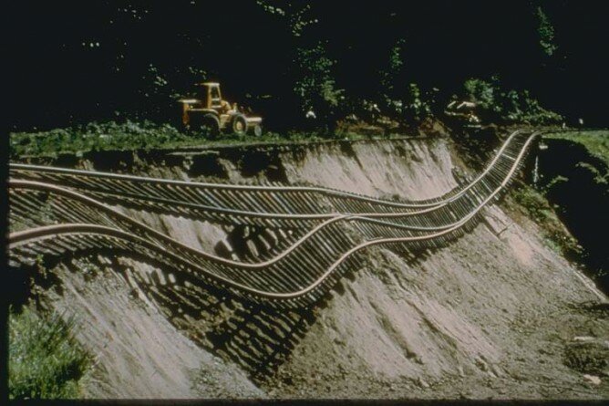
Troost explained that she was using information from boreholes drilled deep into the soil—each one takes three hours to complete—to develop data sets describing the soil types for various parts of the area, which is “a very complicated geologic setting,” as she said. The mapping process also used Lidar, which sends laser streams down through the soil to detect the density and moisture of its varied layers, to obtain a much more precise and deeper set of data about the earth we live upon. Polygons drawn on a map classified these various soil types and provided data about each section defined by the polygon.
Before GeoMapNW began, the last soil maps for Seattle had been done in 1962: most of Interbay, downtown, and Sodo was a blank on those maps, even though those areas have just about the most unstable soils in the city. The value of the new mapping lies in both covering that unknown ground and in its establishment of finely detailed maps of areas that had been only roughly sketched by the earlier mapping projects.
GeoMapNW also revealed several valuable surprises: Loose, unstable soil exists not just along the shorelines of Puget Sound and filled-in areas like Harbor Island and SoDo, but also on hills, at the tops of hills, and in the middle of West Seattle. You may think that your home or office is on firm ground because it isn’t near water, but this isn’t necessarily so. The many layers of sediment laid down around Seattle by glaciers, volcanic flows, and erosion may have established seemingly firm ground, but they do not constitute bedrock.
The new maps done by GeoMapNW required about 300 soil borings for each square mile: this meant that, in a sense, it was not inexpensive work, taking 900 hours to map just one square mile of sprawling urbanity. It cost $500,000 to operate GeoMapNW for one year. But, the knowledge furnished by GeoMapNW gives soil engineers and architects the ability to make preliminary plans for how to prepare a site for the construction of a building, and for infrastructure projects such as roads, sewer lines, and rail tunnels. By looking at the new maps, they get a clear sense of what the building site is like before going to the site, surveying it, and beginning construction.
Obviously, it’s hard to calculate the value of using the GeoMapNW data to put up buildings that do not tumble down in an earthquake or mudslide. But, we can guess at the cost of replacing just a couple of buildings destroyed by a disaster because they were designed without using new data on soils, as well as the casualties suffered by those building failures. Comparing that avoided cost to the salaries paid to some of Seattle’s most expensive and least productive sports stars, or to some of the compensation packages handed out to executives at WaMu, is a pretty bad joke.
The halt to the GeoMapNW project is an example of the long-term harm that can come from bad budgeting, which governments are just as susceptible to as households and businesses. It’s not at all hard to envision Troost and other geologists and engineers saying, after the next bad earthquake, that “if we had kept our mapping going, we would have been able to avoid this building collapse, those deaths, this bridge collapse.” Indeed, Troost told me, “The government agencies are shooting themselves in the foot by not funding this project. It would cost them more work and trouble if it ends.”
The cities that had the most extensive mapping of their soils done by GeoMapNW include Seattle, Redmond, Bainbridge Island, Bellevue, Kirkland, and Mercer Island: the wealthier parts of the Puget Sound, the areas that are best able to deal with and recover from an earthquake. You get the sense that mapping is a luxurious kind of risk management: while other towns are struggling to plan for ways to deal with casualties and repair broken infrastructure because they simply lack the funds to do retrofitting or exhaustive analysis of building sites, Bellevue, Redmond, and other towns have the tax base to fund such investments.
This is something Carol Dunn of Bellevue’s Office of Emergency Management pointed out to me: the best prepared areas are usually those that have the most resources and have the most to lose, financially speaking, from natural disasters. These aren’t necessarily the same areas that are most vulnerable to a natural disaster.
Troost was “always giving away maps” even while struggling to keep her project going; she was considering putting in a subscriber-based database by July 2010 to provide a new funding source for the project. It didn’t happen, but this struck me as a good idea: it seemed completely ridiculous for anyone to think that the information GeoMapNW provided was or should be free. After all, private geotechnical and soil surveying firms don’t give away their work, and it was entirely reasonable for those firms to help cover the funding crunch by contributing to the maintenance of a resource that helped them do their work.
GeoMapNW was not recklessly burning through its funding: The GeoMapNW headquarters were located in the old University of Washington oceanography building, in a very quiet and neglected area behind the UW hospital, near a dock on Portage Bay. It was not a high-overhead operation, and most of its work was being done by grad students.
In spring 2010, Troost said the impending end of GeoMapNW was revealed around the turn of 2010, when local agencies apparently realized quite suddenly that they had to cut their budget for the upcoming year because they were simply running out of funds for discretionary projects like GeoMapNW.
They told her, in effect, “Sorry, we don’t want to do this, but we have to cut our funding to you.” Two years later, the result of all those cuts is the discontinuation of the mapping project and its existence as a static, limited, free resource. So if you’re living or working in Tacoma or Puyallup or Everett, you can still go to the GeoMapNW site, but you won’t get any new information about your soils: the project didn’t get to your area before the funding ran out.
The closing of GeoMapNW was indeed unfortunate since a regional database and growing coverage by high-resolution geological maps was stopped before completion. The article can use a few clarifications: 1) while the GeoMapNW website has borehole data for viewing and downloading, site specific subsurface investigations are still needed for most development projects; 2) we only did a database of subsurface data for Bainbridge Island, not the geological map; 3) Lidar is used to map topography, not soil density and moisture; 4) many factors determine the seismic stability of structures and new geological mapping only shows where vulnerable ground may exist. To use the database of boreholes and view geological maps of Seattle, Kirkland, Mercer Island, and soon, Bellevue, go to http://geomapnw.ess.washington.edu/