


Late last summer, destruction began on Elwha Dam, and then with the river no longer backed up, forming Lake Aldwell, the Elwha River rushed free. Now the Glines Canyon Dam is taking a beating, and that too should be down by the end of the summer. It’s part of a long-in-coming Elwha River Restoration project that will bring salmon back up the river, unhindered by the dams. Sediment dropped behind the dams is now being sluiced away, and forming new beachfront at the river’s mouth.
A rainy weekend in Seattle seemed as good a time as any to visit the sodden Olympic National Park (admission $15 per vehicle, $5 bicycle or motorcycle), so The SunBreak’s Dam Removal Assessment team, in a red rented Kia Soul from Budget, took off to see what we could see.
A ride on the Edmonds-Kingston ferry ($13.25 for car and driver, $7.70 per passenger) puts you on SR 104, which you take across the Hood Canal Bridge, and out to Olympic Highway 101. This takes you north, then west, out to Port Angeles and to the non-existent Lake Aldwell. An overlook off the highway is your indicator that you’re close.
(Earlier, you can take a right on the 112 to Lower Dam Road, which leads you to a lot and a gravel path, short, not too steep, that gives out on a view of the missing dam. But you probably want to get your boots muddy, so continue down 101.)
Then you have a choice between a left on Olympic Hot Springs Road (leading up toward the Glines Canyon Dam) and a right on Lake Aldwell Road (which gives out in a small parking lot at the edge of the lake bed). The Olympic Hot Springs Road takes you into the National Park, with its admission fee, and for safety reasons, the Park Service is not all that interested in having you poke around the dam deconstruction site.
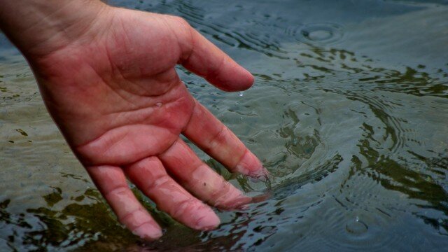
From the Hot Springs Road, we took the Elwha Valley’s Whiskey Bend Road, a five-mile, one-lane, part-gravel, part-dirt forest road–but beginning today, that will close from 7 a.m. to 5:30 p.m. daily until June 29, to keep cars from “arguing” with heavy trucks carrying material away from the site. We had hopes of spying on the dam’s removal, but those turned out to be fruitless. Instead we hiked about two miles in along the river, dropping down to see its torrential twist through the Goblin Gates into Rica Canyon. Before the dam, the water is clear, a little greenish, but after it’s a dull gray, choked with sediment, and looks almost like a thin cement.
Back at the former Lake Aldwell, it’s at first hard to tell where the river might be. You drop down from the parking lot into a dry river-rocky channel, and then up and down bare or regrowing banks. Walking in the general direction of the river means working around the steeply cut banks, which can be terraced ten feet high or more. The river’s rush, down in its new channel, is overwhelmed by traffic noise until you’re right on it, and the last approach requires prudence. The river is eating away the silty banks you’re standing on, so watch for those cracks that signal another slice is being taken out.
Wandering up and down the lake bed is eerie. The charred stumps of giant cedars, hundreds of years old, half a millennium, still have cuts at their base, where loggers put planks to stand on. The ground shifts from sandy silt to rounded rocks to red clay. Hawks circle overhead. On one side, the river slices through it all, sluicing away tons of sediment piled up over the past century (the Elwha Dam v. 1.0 was built between 1910 and 1912, but it had to be partly reconstructed in 1913); on the other, nature is busy throwing out roots wherever possible.
Next come the chinook.