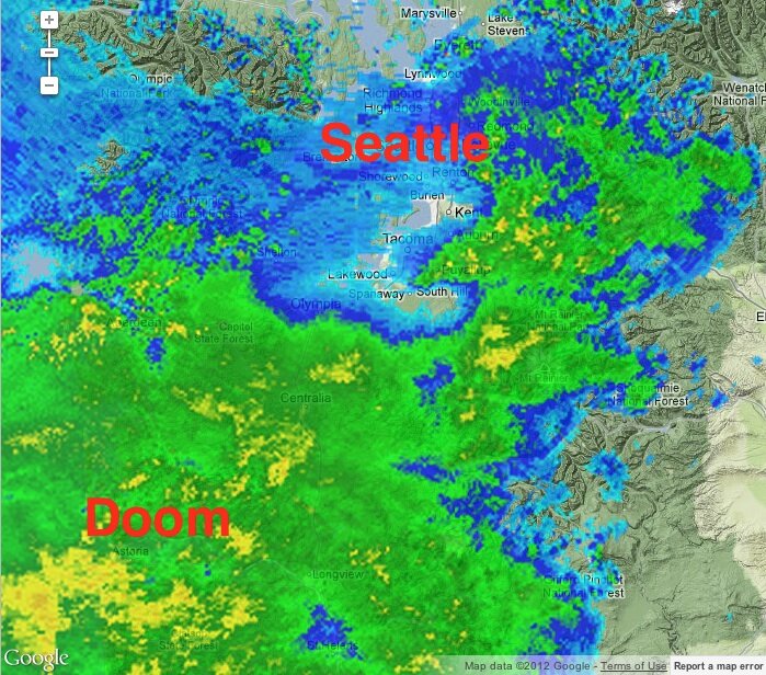
It’s our turn. With the Sandy Formerly Known as Hurricane walloping the East Coast still, Seattle finds itself in the path of an atmospheric river. Nothing we haven’t seen before, but enough to raise some minor-flooding warning flags on rivers in Mason, Whatcom, Snohomish, and Skagit counties. “Expect about 1-2 inches of rain in the lowlands and 2-5 inches in the mountains,” says KOMO Weather.
“HEAVIEST RAINFALL WILL PROBABLY OCCUR FROM ROUGHLY NOON THROUGH MIDNIGHT TODAY,” says the National Weather Service–not in alarm, that’s just how they talk. The rain will taper off Thursday into Friday, but may return for the weekend. Forecasters are still eyeballing a model that shows the worst of it passing to the north of us.
In urban settings, any flooding is likely to be the result of leaves and other debris clogging up drainage. But be ready for anything: The Stranger‘s Dan Savage had the wind last night dismantle a gutter, which directed its water into his kitchen. If you’re feeling civically minded, you can Adopt a Drain, and the city will give you the tools needed to keep it from clogging up. Your neighbors will cheer as you stride purposefully into the teeth of the gale, rake held high. Here are the King County online flooding resources.