Tag Archives: earthquake

The Great Washington ShakeOut, an Earthquake Drill, Set for Thursday Morning

In Part 2 of this series (Part 1 here), The SunBreak’s Northwest Earthquake Correspondent Arne Christensen checks in with John Schelling (@jdschelling) of the Washington Emergency Management Division about earthquake preparation, in advance of the state’s ShakeOut preparedness drill on October 18th.

Arne has also written a previous series on earthquake preparedness in the tech sector, and the psychology of readiness. He also maintains this Nisqually Quake site, which collects stories on the subject. 

The ShakeOut, the largest-ever earthquake drill in Washington, is coming up on October 18th. I’m sure a lot of schools have signed up for it, but is it hard to get adults to participate in these sorts of drills? Do you hope that kids will recruit their parents into preparedness after doing a ShakeOut at school?

One of the central tenets of the ShakeOut is to get families, friends, and neighbors to talk about what they did at school, home, work, etc., during the ShakeOut earthquake and tsunami drill. This helps foster conversations about preparedness and reinforces the need to get drop, cover, and hold into our muscle memory–and running to high ground after the shaking stops if you’re near the water.

So, if kids come home from school and talk about what they did at school today and parents talk about what they did–and they both participated in the ShakeOut–it can lead a great discussion about how well the family is prepared, and encourages them to follow through on anything they still need to do to. If you haven’t registered to be part of the largest earthquake drill in history, The Great Washington ShakeOut, it’s not too late to sign up.

There’s no doubt that getting kids to participate in school is easier, but that in and of itself is so vitally important for a couple of reasons. First, it will promote the discussion that I mentioned previously and may encourage parents to support participation in the workplace during future drills. Second, it leads children to become better prepared adults and promoting earthquake safety within their own families.

As for [workplaces] looking at the drill as a distraction, the drill itself takes less than a minute to run through using the 57-second recording we have provided. Companies can play the drill notice over their PA systems and have people practice Drop, Cover, and Hold under their desk. A two-minute or less disruption to daily business operations is a good investment in keeping a company’s human capital safe.

We have big and small businesses alike signed up for the ShakeOut this year, and our goal will be to continue to promote earthquake safety and encourage participation to the greatest degree possible. My goal is to double participation in our businesses community during next year’s drill.

I’m sure social media (the ShakeOut is on Twitter!) and smart phones have really changed the way you do disaster education. What are the major advantages of the new technology? And are there any significant problems created by it?

Social media and the creation of smart phone apps have opened up so many new opportunities to engage people in disaster preparedness. It allows public educators to help spread the word to people and groups much more directly and much more quickly. It also allows users to only receive the information of interest to them.

What we have seen is that when misinformation is initially spread within the user community, other users quickly step in to make corrections. Social media has also empowered people within their communities to connect virtually and create neighborhood preparedness groups online through Facebook and other social sites. A great example of this grassroots effort in Pacific County is Eye of the Storm. This group originated through Facebook and is now organizing annual preparedness fairs to promote earthquake and tsunami preparedness within their community!

As for drawbacks, I think it’s important for preparedness educators and emergency management organizations to recognize that the digital divide still exists and not everyone has a smart phone or uses mobile applications. There are people out there who don’t own a computer or use the Internet, and we still have many places throughout Washington State that don’t have cellular or mobile data coverage, so it’s essential that we continue to reach out to everyone–regardless of their expertise with or access to technology.

In addition, it can sometimes be challenging to provide a response to user communities that operate on a 24/7 basis with employees that are scheduled to work from 8 to 5. However, these are not new issues and are to be expected with any new technology. I’m confident that individuals and organizations will adapt to meet these needs.

Prepared for an Earthquake? It’s Disaster Preparedness Month.

In Part 1 of this series, The SunBreak’s Northwest Earthquake Correspondent Arne Christensen checks in with John Schelling (@jdschelling) of the Washington Emergency Management Division about earthquake preparation, in advance of the state’s ShakeOut preparedness drill on October 18th. Arne has also written a previous series on earthquake preparedness in the tech sector, and the psychology of readiness. He also maintains this Nisqually Quake site, which collects stories on the subject. 

Still from the movie 2012 (Columbia Pictures)

Aside from “drop, cover, and hold on,” what’s the most important thing people can do to prepare for earthquakes?

Anything! If people can do at least one more thing to become better prepared for an earthquake, they will definitely be prepared for the disasters that occur more frequently in Washington. Personally, I recommend everyone have a plan! It doesn’t have to be something long and complex…a piece of paper or two will work just fine.

Your plan should include some basic details, such as phone numbers for out-of-area contacts (best to have more than one in case your first choice isn’t home!), and depending upon your situation it should include numbers for schools, daycares, adult family homes, primary care doctors, and numbers for vets and locations of pet-friendly hotels if you have loved ones with four legs.

Your plan should identify specifically where you will meet your family in your neighborhood, as well as places that you would meet in case your home and neighborhood are inaccessible. Our family meeting place inside our neighborhood is at a park next to our house, in case we have a fire or have to evacuate separately. Outside of our neighborhood, we plan to meet at my wife’s office. You should contact your local emergency management office or Red Cross Chapter to determine locations of shelters in your area and have a primary and secondary choice. You may also want to include phone numbers for the shelters in your plan.

Can you see the theme here? Yep, it’s redundancy. It is best to have a primary and a secondary choice for each part of your emergency plan since we cannot rely on just a single point of contact, rendezvous point, etc. Also, make sure all of your family members have a copy in a waterproof container, like a ziplock baggie, that they can keep in a backpack, car, school, office, and home.

What people, families, neighborhoods, communities, do today to prepare will determine how quickly they recover from our next disaster. It will also give them peace of mind knowing that they have done everything they can to help themselves and their families. Building and exercising a plan allows a person to spring into action rather than by crippled by fear or panic when faced with an otherwise frightening situation.

4.0 or greater Northwest quakes from 1970 to 2010 (Chart: Arne Christensen)

Do you think people should try to make themselves more mindful of disaster threats on a day-by-day basis (such as noting the Northwest’s many small earthquakes), to educate and train themselves for when a disaster does happen? Or would that simply create a lot of useless worry?

Since Washington generally experiences on average four or so earthquakes per day, I wouldn’t suggest that people try and keep track of them or needlessly worry. However, I would highly recommend over the course of one year Pacific Northwesterners do at least one activity per month to help themselves and their families become better prepared.

We’ve developed an easy to follow program called “Prepare in a Year,” which is designed to help people get ready over a 12-month period by dedicating just one hour per month to emergency preparedness.

Already prepared? Well…now it’s time to think global and act local. Okay, maybe not global, but at least think about your neighbors! If you haven’t met them before an earthquake, I can almost guarantee that you’ll meet them afterwards. So, why not start working together to get your street, your cul-de-sac, the floor in your apartment building, ready beforehand?

Wouldn’t it be great to know by name exactly who you could turn to in your neighborhood for a skill or a resource in an emergency? Think about how reassuring it would be to know that your neighbors two doors down have CPR training, or that your neighbor across the street is a licensed amateur radio operator and can communicate directly with responders when phones are down?

To help make neighborhood and community preparedness easier, we’ve created an award-winning program called Map Your Neighborhood, which builds on the age-old concept that neighbors can help neighbors respond and recover from the events that Mother Nature throws our way. You can check out our website and then contact your local emergency management office to get involved.

I also suggest that when you feel a smaller earthquake or hear about something happening halfway around the world, like the Japan earthquake and tsunami, pause–for just a minute–and really assess what you have done to date. Would you have been ready? If not, take that first step: I promise you’ll feel so much better after you do! There’s no need to worry if you take steps ahead of time to prepare your family, your home, and your workplace for the unexpected.

The Pacific Northwest Has Got the “Tiny Quake” Shakes

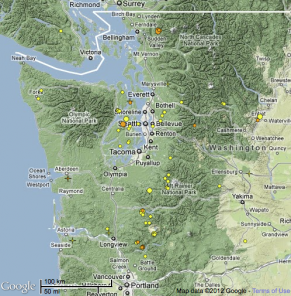
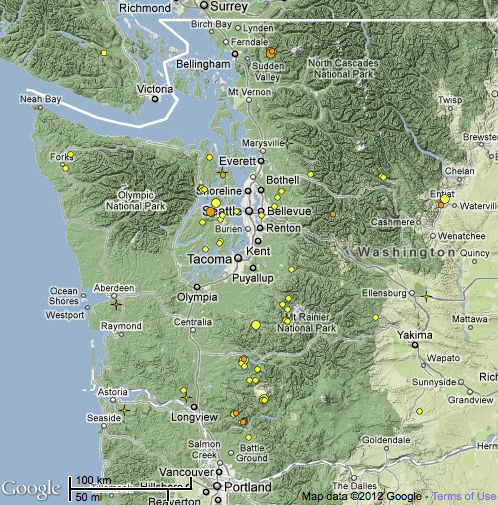
Image from Pacific Northwest Seismic Network, using Google Maps

Remember our “Two Tiny Quakes” post two weeks ago? Maybe you thought things had quieted down, but actually we just couldn’t keep up.

As KING TV’s Glenn Farley reports (“Swarm of mini earthquakes recorded throughout W. Washington“), this week has been especially active in Western Washington, with six quakes Tuesday, fourteen Wednesday, and eleven on Thursday.

To date, our portion of the Pacific Rim’s Ring of Fire is merely feeling peptic: Some of these quakes are truly tiny, 0.2 and 0.4 magnitude on the Richter scale. But a 2.4 hit near Woodburn, Oregon, a little after 5 a.m. this morning, and quakes in that range have not been uncommon in the spate of recent incidents.

Most are relatively shallow, six to twelve miles down, but one, a 1.8 on April 18 near Skykomish, was 60 miles deep. That’s deep down in the subduction zone, where the Juan de Fuca plate is being smooshed beneath the North American plate.

What it all means is anyone’s best guess. It could be relatively trivial “jostling” between the plates. Or it might not be trivial. (In contrast, not much is going on at all with our slow-motion tremors, except for some activity near the southern tip, near Redding, California.) More research, as they say, is needed.

UPDATE: The Pacific Northwest Seismic Network’s John Vidale says, “I think it is mostly that we are looking more closely with our new software, and seeing a larger fraction of the small earthquakes that were always happening.” He’s also not sure that tiny quakes were being plotted on their map, previously, which is probably smart, as seeing so many of them alarms the easily alarmable.

Alternate theory

To give you an idea of how much more research, Oregon Public Broadcasting is just reporting on the discovery of “two previously unknown earthquake faults–and possibly a third–near Bellingham, Washington.” That’s the sort of thing people like to know, if their house is sitting of top of a fault or not. Here in Seattle, SoDo is the site of new liquefaction research. (What’s liquefaction?) Paul Bodin describes the “liquefaction array”:

The array consists of accelerometers to measure the 3D shaking at the surface and at 5, 45, and 56 meters deep, and piezometers at 7, 23, 29, 42, 47 and 52 meters deep, as well as a surface barometer needed to “correct” the buried piezometer data.  We can observe the shaking levels at these depths, and calculate the strains in the ground between them, as well as monitoring the ground-water pressure changes that cause the liquefaction.

Once again, Glenn Farley is on the job, discussing how, even in the absence of major quakes, the array is picking up information from heavy freight trains that send vibrations deep into the earth. It’s cheap seismography, letting scientists peer into the ground beneath our feet and map its behavior.

Two Tiny Seattle Earthquakes Friday Morning

(Screenshot: PNSN)

Beaux Arts, the little village on the eastern shores of Lake Washington, was the site of a 1.7 magnitude quake this morning, at 8:24 a.m., with a 1.4 quake following exactly an hour later, in the Puget Sound just off Bainbridge Island. (View the details at the Pacific Northwest Seismic Network’s recent earthquakes map.)

Both were at a depth of 14 to 15 miles, and would look to be on the Seattle Fault, which some 1,100 year ago delivered a magnitude 7.3 quake whose traces are still visible today.

A 2005 research article on that earthquake, notes our friends at Nisqually Quake, said the event “caused 7 m of vertical uplift on the southern side [of Seattle Fault], sent massive block landslides tumbling into Lake Washington, and created a tsunami in Puget Sound that left sand deposits on Southern Whidbey Island.”

The Suquamish tribe remembers the day very well (again, from the Nisqually Quake):

Long ago, when this land was new, the area we know as Agate Pass was much smaller than today…. There lived in this…body of water a…Giant Serpent. The Double Headed Eagle flew over the pass and the Giant Serpent came up very angry. The two began to fight, and the earth shook and the water boiled…the people began to scream and cry until it was as loud as thunder.

Then, as if the earth was going to be swallowed by the waters, they began to boil and churn. Then, the Double Headed Eagle exploded out of the water and up into the sky with the body of the Giant Serpent in its claws. The Double Headed Eagle flew back into the mountain and behind him was left the wide pass….

The point being, we got off lucky this morning. TGIF.

British Columbia Coal is Blowin’ Up!

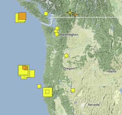
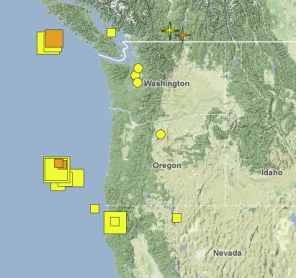
Seismic excitement magitude 2 and above, the last two weeks (Pacific Northwest Seismic Network)

With the recent Eureka, California, earthquake registering 5.6 (not that serious, compared to their 6.5 in 2010) and the 6.0 roughly 160 miles out to sea from Coos Bay, Oregon, it seemed a good time to visit the Pacific Northwest Seismic Network to what the big picture showed regarding our squeaky Juan de Fuca plate.

But what were those little stars up near the Washington-British Columbia border? I checked the map’s key. “Explosions”?

Curious, I started clicking around to see if we were under unannounced invasion, and discovered PNSN was already on it, with a blog post on British Columbia coal mine blasts.

As grad student Alicia Hotovec explains:

Turns out the signal most likely originated in southeastern British Columbia, somewhere near Elkford. I Googled the area, and there are several sizable coal mines nearby. One of the techniques used to efficiently extract material from mines is something called ripple-fire blasting. Charges are set off with short but consistent time delays, usually around a tenth of a second apart.

That delay generated a peculiar harmonic signal “heard” at various volcanic seismology sites. The size of this blast is “not unprecedented,” according to the UW’s Steve Malone, who has had his ear to the Northwest ground for longer than most.

Still, if we’re eventually overrun by Canadians emerging from secret underground tunnels beneath the border, don’t act so surprised.

More Quake News Surfaces in Pacific NW Seismic Network Site’s Redesign

Quake bugs (and the people who love them)! This one’s for you. The Pacific Northwest Seismic Network, long a treasure trove of real-time and archived data about seismic activity in the Northwest, has finally gotten around to designing their website, and bringing their terrific visualizations to the surface.

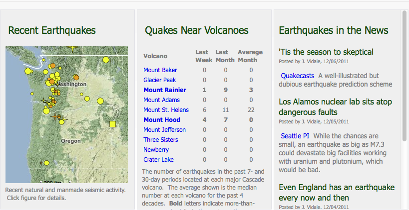
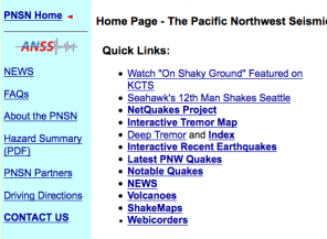
Before, the home page looked pretty much like this –>
Until you clicked on the boring hyperlinks, you had no idea that there were such fun and interactive maps and visualizations underneath there.

Plus, AQUA!

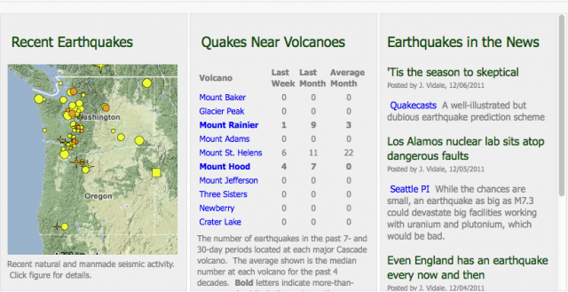
Now you get that great snapshot of recent quakes (don’t worry, we get a lot of small quakes), plus a Volcano Watch section, which tells you at a glance which of our area’s ten volcanoes is about to snuff out life as we know it. Ha ha! No, we have fun. And in fact, after a busy November, with nine earthquakes in its vicinity, Mount Rainier seems to be relaxing a bit. Mount Hood, on the other hand, had four last week.

Good luck, Oregonians. We’ll see you on the other side.

On the blog, you can read about under-the-hood changes regarding the software that generates the views you see, and, closer to home, about the Interlaken readings that would seem to show that Sound Transit tunneling is noisy work. CHS reported on the construction-related shaking back in mid-November; Montlake residents had been feeling the vibrations since the beginning of September. Sound Transit thinks it’s due to the trains traveling the tunnel-in-progress:

Based on what we learned in the Shelby-Hamlin neighborhood, we believe the source of the complaints is Ground Borne Noise (GBN). GBN is caused by vibration traveling through the earth and interacting with the structure of a building, creating an audible noise. In the Shelby-Hamlin neighborhood, we know the GBN is caused by the supply trains delivering materials to the Tunnel Boring Machines (TBM), and we suspect the same is true in the Boyer neighborhood.

Judging from the triggered seismographic events, they still have some work to do on quieting things down, down there.