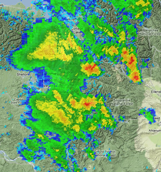
Hey, what gives? Early- to mid-July is normally the time when summer arrives and Seattle dries out quite a bit–on average, it’ s our driest month of the year–but instead the Puget Sound area has been rocked by an unusual string of thunderstorms, thundershowers, and flash floods. This morning’s downpours are courtesy of Hurricane Fabio, which two days ago was 670 miles west of the southern tip of Baja California. Can’t we build a huge fence?!
KOMO’s Shannon O’Donnell explains this out-of-market weather is due to a series of giant sucking lows located above us:
Since that point in early July, we’ve more or less kept an upper level low somewhere nearby the Northwest. The circulation wrapping around the low has continued to pull up monsoonal moisture from the Desert Southwest, allowing thundershowers than are commonplace in Arizona and New Mexico to meander all the way up north into our neck of the woods.
This has given University of Washington meteorologist Cliff Mass the chance to explain to you what altocumulus castellanus clouds are and why you shouldn’t shelter under trees, along with a brief history of notable flash floods of the past, compared to cloudbursts this time: “For example, a thunderstorm hit the Okanagan area near Omak around 2:30 p.m. Sunday afternoon, with over two inches over a one-hour period at the Malot AgWeatherNet Station.”
In meteorological theory, this particular moisture-vacuuming low will move north by this afternoon, and we will back into our marine-layer-morning, afternoon-sun pattern for Saturday–followed by yet another upper-level low Sunday night, bringing clouds and rain. Get used to that meteorological two-step, because KOMO’s Scott Sistek says NOAA doesn’t see much reason for August to be different.
While the rest of the U.S. sits panting with its tongue hanging out, the Northwest is enjoying substantial cooling produced by coastal upwelling. As of July 18, Sistek reports, “the thermometer at the University of Washington Atmospheric Sciences Department which, unlike Sea-Tac Airport, keeps an actual minute-by-minute log of the weather station atop their roof,” has registered just 50 minutes of 80+ degree weather. That’s actually less than last year. (In fairness, if you go by what makes a Northwesterner deliriously happy, a balmy mid-70s, we have reached that mark 12 days over the past 48.)