If Seattle’s meteorologists were a sports team, they’d be winning national titles. We have some tremendous talent around here, thanks to the Northwest’s ability to attract data-crunching nerds of all kinds. But over at KOMO, meteorologist Scott Sistek is about as native as it gets. Born in Port Angeles, he got his atmospheric sciences degree from the University of Washington. (Bow down, cirrostratus!)
Like the venerable Cliff Mass, Sistek also keeps a weather blog: Partly to Mostly Bloggin’, where he tracks things like “gloomiest days” and provides gift-giving ideas for meteorology bugs. He’s also a tweeter.
Knowing he likes to talk weather, we thought we’d try to get the inside scoop on a few things, and Sistek delivered.
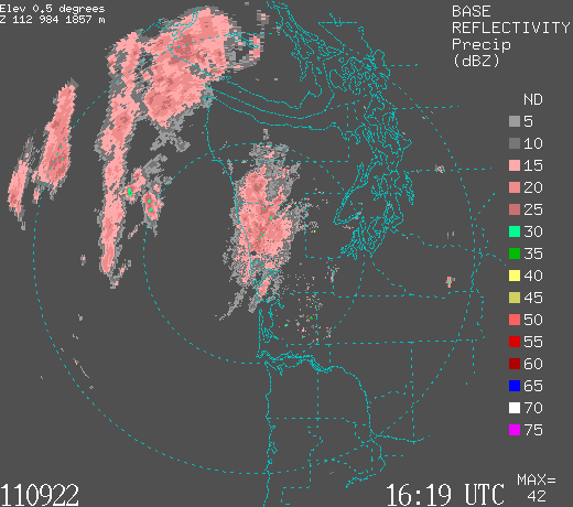
Let’s talk coastal radar. It lets us see what’s coming Seattle’s way earlier, we know. Now that you’ve had the chance to work with it, can you describe the impact?

The coastal radar has been a godsend for local weather forecasters, and now that we’ve had it a year, I can’t imagine life without it.
The best example I can think of where it was a big help was the January ice storm–we were able to actually see the area of low pressure on the radar and pick out its nuances to at least get an idea of how that snow/ice storm was evolving, because it wasn’t exactly following where the forecast models had indicated it would go.
It was easy to compare to a similar snow event that had happened in early 2011 before the radar was in where the snow managed to mainly miss downtown Seattle (yet dump 30 inches of snow in Mount Vernon). The exact position of that low created a large rain shadow (“snow shadow” in this case) over Seattle and Bremerton–something that was difficult to see without radar coverage.
But in a double benefit, having the radar has been helping our forecast models in providing a treasure trove of additional data for the models to use in their calculations–especially over the void waters of the Pacific Ocean near the coast as well.
It’s also been a big help in being able to track thunderstorms that move into the coast and sometimes into the Puget Sound region. It’s been an eye-opener for me to see how many thunderstorms roam around off the coast during cold, unstable weather patterns.
The Olympics still provide some interesting twists in our weather stories, as does the infamous Puget Sound Convergence Zone. Even with better radar, can you still get really fooled in the short-term?
Oh absolutely–especially with Convergence Zones. The coastal radar is great seeing a band of heavy rain that is offshore and knowing when that rain will reach us, but with Convergence Zones, they are their own beasts. We can get a good idea of when the pattern will form based on the expected low-level winds and roughly where it will be located, but sometimes they sneak up on your, and predicting how long they’ll last and how intense they’ll be–and still to a certain extent, where it will form–can create a few surprises. Make conditions marginal enough for lowland snow and now you’ve got all sorts of headaches.
And then there is the challenge of wording a forecast to nuance the convergence zone–even when we know it’s coming, trying to convey that some of you are going to get wet (or snowy) and others will get nothing. In fact, it’s not unusual to have clear skies 10-15 miles on either side of an active zone. So telling the Lynnwood person to prepare for 6 inches of snow while, in Seattle and Marysville, you’re getting squat, is a challenge–although as someone who lives in the Convergence Zone area myself, most of the longtime residents do understand that they get picked on.

Part of the trick to weather forecasting, is translating Nate-Silver-ish probabilities for people who want to know whether to bring the umbrella (or GoreTex) or leave it at home. Is demand for precision making it more difficult to maintain a true “fuzziness” in prediction?
It does make it more obvious when we’re wrong! Although we can give a pretty good short-term forecast based on radar trends, we’re not to the point where we can say, “It’ll rain in Tukwila in 8 hours and 12 minutes”–forecast models aren’t quite that precise yet and it’ll take some major additional advances in technology and computing power to get that precise that far out. So there is still a need for “scattered showers” Monday as opposed to “rain between 2 and 2:15 pm on Monday,” because the precision is not there yet beyond a few hours. We can get pretty good a day or two in advance for general time frames: “Steady rain in the morning, tapering to showers in the afternoon” but setting a watch by it is still some years away…unless the rain is like 20 minutes away.

Radar picks up all sorts of things, besides clouds, rain, and snow. What are some of the things you have to be careful about in a “radar map is not the territory” way?
Really the largest “gotcha” is when it’s a clear or dry period in the fall and winter, during the evenings and mornings, and the radar picks up migratory bird patterns. The radar will see those millions of birds and paint what looks like splotches of rain across the region when it’s obviously clear outside. We do get a few confused emails on it, and we try to explain what is going on. It only happens when the birds begin their trek north (spring) or south (fall) and during the early morning and late night hours. We can’t filter it out though because then the radar would also ignore legitimate rain.
Microclimates! Seattle must have them, but they don’t seem as prominent in public awareness as they are in, say, San Francisco where it can be both foggy-and-50 and clear-and-82. Discuss.
Seattle has dozens of microclimates and I’d say we challenge San Francisco as far as number, only ours aren’t quite as stark. However, San Francisco cheats a bit in that their population spreads out further. Imagine if the mountain passes were a flat freeway and Wenatchee and Ellensburg were considered in the Seattle metro area–now you’ve got similar microclimates in the “Seattle area” that San Francisco does.
But as far as west of the mountains, you’ve got the rain shadow that has Sequim at 18 inches of rain a year as opposed to Forks at 120 inches, Seattle at 37 and Olympia pushing 50. The Convergence Zone areas of Snohomish County on average get 10-30 days more rain a year than just 20 miles away in Seattle.
On stormy days, winds can gust to 60 mph on the coast, 55 mph on Whidbey Island, but it’ll “only” gust 30-35 mph in Seattle–and be dead calm in Port Angeles and Sequim. Meanwhile in the late fall and winter, you can get an east wind event where even though it’s blazingly sunny outside, winds will roar 50-70 mph in places like Enumclaw, Gold Bar, and North Bend, and gust 30-40 mph in Renton and South Seattle, but be nearly calm North Seattle.
We’ve had recent weather systems where warm air pushed into the South Sound and bought temperatures into the upper 60s while just 45 miles away in Everett it was in the 40s. Even at nights in the winter, it’s routine for outlying areas to drop into the mid 20s while Seattle proper stays above freezing. But in the summer, spots near the water can be in the upper 70s, while it’ll be in the low-mid 80s just away from the water, and perhaps pushing 90 in the foothills. While on the coast, it’s foggy and in the upper 50s to low 60s.
You can see the challenge we have trying to squeeze that into a simple forecast!

You’re a native. Help newcomers adapt to life as a Northwest mushroom: Do you let rain coop you up inside? Where do you go for a mini-vacation from cloud-cover? Describe your workaday “it’s gonna rain” apparel.
Yes, a great day for me is in the 50s or 60s in the summer. It is amazing that this area has those who love the sunshine as you’d expect, but there is also a very large contingent of “rain fans,” as I call them, who like me really enjoy a cloudy, rainy day. I can’t say exactly what it is, something about rain I find soothing. Those days when it’s a low overcast and the fog is drifting through the tree tops and it’s the drip-drip of rain amid a cool breeze is really refreshing.
But I certainly understand those who are not big fans of that weather and want to dust off the flip-flops from time to time would struggle with our climate, just as I’m sure I’d struggle living on the East Coast in that climate (actually, I have briefly lived there and…no thanks).
I do not let the rain coop me up inside, I think you just learn to not let it bother you. It’s why many locals eschew umbrellas. I will say that our rain here is generally pretty wimpy — it’s usually fairly light and the drops are small so you might get a little wet but you dry off pretty quick. (I always joke that, sure, it rains in Seattle a lot, but it’s a dry rain.) You’ll also find if you try to put off projects for a blazingly sunny day, that for much of the year, it’ll never get done. So you mow the lawn in the drizzle, or this week, put up Christmas lights amid the showers and move on.
So for those new here, I’d say don’t let the rain fool you–it’s lighter than you think and it doesn’t rain all the time, it just looks like it will. And the payoff in the summer–there is no way to argue that we don’t have the best summers in the U.S., possibly the world, there, I said it–should be worth it. So don’t stay hiding inside the house fearing the rain. Go be outside and you’ll soon learn that it’s not that bad, and it’s many times not that wet. There is a reason Seattle gets less annual rain than many other cities like New York or Chicago or Houston–it’s usually not a soaking rain.
In that regard, I really don’t change my wardrobe much based on sun vs. rain (then again, I’m mainly inside either way) but even if I had to walk outside a distance, I’d just soldier on. If I’m going to be outside for an extended period in the rain, a light rain jacket usually suffices–just make sure it has a hood because…you can’t be caught dead carrying an umbrella.