Tag Archives: safety

Seattle Speeders Give School Zone Cameras Something to Click About

(Photo: SDOT)

Back on November 1, 2012, four Seattle school zones got cameras that started snapping pictures of speeders around Broadview-Thompson K-8 School, Thurgood Marshall Elementary School, Olympic View Elementary School, and Gatewood Elementary School. While the schools were selected because of known speeding problems, the city didn’t expect the new cameras to be strobing the way did. In under a month, they’d snapped photos of 5,927 speeders (who got warning notices).

That number is the more alarming when you consider that the cameras only issue tickets when the school zone’s yellow beacons are flashing, usually during the hour as students arrive in the morning and the hour in the afternoon, when they leave. Daunted by the volume, the city decided to give motorists another two weeks to adjust their behavior, vis à vis the accelerator. Starting December 10, speeders will get a ticket for $189 in the mail.

“This is about safety for kids and their parents in school zones. Motorists need to slow down and obey the posted speed limits. This technology will encourage safer driving habits and prevent collisions,” said Chief John Diaz of the Seattle Police Department.

For a counterpoint, we turn to a commenter on the Mayor’s announcement:

This is bunk. Where are all of these “dangerous speeders”. Yes I have kids and am at the school many times during the week. I have been given many tickets by accidentally letting my speedometer drift up to 27 or 28. It is the most irritating thing. In fact it is more dangerous to stare at the speedometer than the road.

School zones are 2o mph, so it’s not that easy to “drift” 7 or 8 mph above without applying some kind of pressure on the gas pedal. But the city gets it. In the Road Safety Action Plan, released back in August, the section dealing with speeding admits: “Many of us cheat a little while driving. We’ve become accustomed to driving five miles per hour over the speed limit thinking that we won’t get pulled over at that speed.”

But it’s not really a question of the letter of the law, or sticklerism: The main thing is that a pedestrian is much more likely to survive being hit by a car going 20 mph or less. That’s “survive,” not “escape serious injury,” and the odds are 9 out of 10. One pedestrian still dies, and one driver is no longer in such a hurry. In 2010, 529 pedestrians were hit by cars in Seattle.  Pedestrians killed were 47, 51, 91, 80, and 48 years old. Four were women.

If the commenter and his or her thousands of lead-footed compatriots retain the need for speed, the City estimates the cameras could bring in between $2 million and $4 million in revenue each year. “The City is exploring options to invest this revenue back into these school zones for additional safety improvements,” says the announcement, adding that of course, “The City would prefer that motorists comply with the posted speed limit in school zones.”

The city’s goal is no traffic fatalities at all. A leading factor is speeding (Between 2006 and 2010, 42 percent of speed-related collisions ended up killing someone. Drunk or otherwise impaired drivers are responsible in 48 percent of fatal accidents in that time frame.)

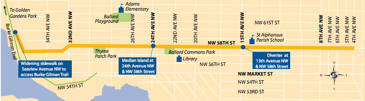
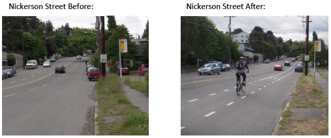
Besides the school zone cameras, the city will continue to park those side-of-the-road radar trailers that publicize your speed and set up speed traps at “hot spots.” In the longer term, they want to “narrow” multi-lane roads where possible, since drivers tend to subtly (or not) race when side by side — these are the dreaded road diets. And they hope to get a bill passed in the state legislature that will let municipalities more easily set slower speeds than 25 mph for residential streets.

Prepared for an Earthquake? It’s Disaster Preparedness Month.

In Part 1 of this series, The SunBreak’s Northwest Earthquake Correspondent Arne Christensen checks in with John Schelling (@jdschelling) of the Washington Emergency Management Division about earthquake preparation, in advance of the state’s ShakeOut preparedness drill on October 18th. Arne has also written a previous series on earthquake preparedness in the tech sector, and the psychology of readiness. He also maintains this Nisqually Quake site, which collects stories on the subject. 

Still from the movie 2012 (Columbia Pictures)

Aside from “drop, cover, and hold on,” what’s the most important thing people can do to prepare for earthquakes?

Anything! If people can do at least one more thing to become better prepared for an earthquake, they will definitely be prepared for the disasters that occur more frequently in Washington. Personally, I recommend everyone have a plan! It doesn’t have to be something long and complex…a piece of paper or two will work just fine.

Your plan should include some basic details, such as phone numbers for out-of-area contacts (best to have more than one in case your first choice isn’t home!), and depending upon your situation it should include numbers for schools, daycares, adult family homes, primary care doctors, and numbers for vets and locations of pet-friendly hotels if you have loved ones with four legs.

Your plan should identify specifically where you will meet your family in your neighborhood, as well as places that you would meet in case your home and neighborhood are inaccessible. Our family meeting place inside our neighborhood is at a park next to our house, in case we have a fire or have to evacuate separately. Outside of our neighborhood, we plan to meet at my wife’s office. You should contact your local emergency management office or Red Cross Chapter to determine locations of shelters in your area and have a primary and secondary choice. You may also want to include phone numbers for the shelters in your plan.

Can you see the theme here? Yep, it’s redundancy. It is best to have a primary and a secondary choice for each part of your emergency plan since we cannot rely on just a single point of contact, rendezvous point, etc. Also, make sure all of your family members have a copy in a waterproof container, like a ziplock baggie, that they can keep in a backpack, car, school, office, and home.

What people, families, neighborhoods, communities, do today to prepare will determine how quickly they recover from our next disaster. It will also give them peace of mind knowing that they have done everything they can to help themselves and their families. Building and exercising a plan allows a person to spring into action rather than by crippled by fear or panic when faced with an otherwise frightening situation.

4.0 or greater Northwest quakes from 1970 to 2010 (Chart: Arne Christensen)

Do you think people should try to make themselves more mindful of disaster threats on a day-by-day basis (such as noting the Northwest’s many small earthquakes), to educate and train themselves for when a disaster does happen? Or would that simply create a lot of useless worry?

Since Washington generally experiences on average four or so earthquakes per day, I wouldn’t suggest that people try and keep track of them or needlessly worry. However, I would highly recommend over the course of one year Pacific Northwesterners do at least one activity per month to help themselves and their families become better prepared.

We’ve developed an easy to follow program called “Prepare in a Year,” which is designed to help people get ready over a 12-month period by dedicating just one hour per month to emergency preparedness.

Already prepared? Well…now it’s time to think global and act local. Okay, maybe not global, but at least think about your neighbors! If you haven’t met them before an earthquake, I can almost guarantee that you’ll meet them afterwards. So, why not start working together to get your street, your cul-de-sac, the floor in your apartment building, ready beforehand?

Wouldn’t it be great to know by name exactly who you could turn to in your neighborhood for a skill or a resource in an emergency? Think about how reassuring it would be to know that your neighbors two doors down have CPR training, or that your neighbor across the street is a licensed amateur radio operator and can communicate directly with responders when phones are down?

To help make neighborhood and community preparedness easier, we’ve created an award-winning program called Map Your Neighborhood, which builds on the age-old concept that neighbors can help neighbors respond and recover from the events that Mother Nature throws our way. You can check out our website and then contact your local emergency management office to get involved.

I also suggest that when you feel a smaller earthquake or hear about something happening halfway around the world, like the Japan earthquake and tsunami, pause–for just a minute–and really assess what you have done to date. Would you have been ready? If not, take that first step: I promise you’ll feel so much better after you do! There’s no need to worry if you take steps ahead of time to prepare your family, your home, and your workplace for the unexpected.

Uff Da! Ballard Defies Trend Toward Cycling on Safer Streets

“A cycling renaissance is taking place in America,” declares The Economist, adding that:

Cities are increasingly vying to be bike friendly. Among them, Chicago wants to become the most cycle-friendly large city in the country—and has said it will build over 30 miles of protected cycle lanes this year. At the moment it ranks fifth, according to Bicycling magazine. Ahead of it are Washington, DC, Boulder, Colorado, Minneapolis and Portland, Oregon.

Portland! In USA Today, the headline reads, “In Portland, Ore, bikes rule the road.” That’s with about six percent of commuters cycling to work. A follow-up story discusses the ways in which Portland is a paradise in contrast to other U.S. cities, while actual Oregonians cast a cold eye on the “paradise” rhetoric.

For context, Le Monde has a recent story on the future of bikes in cities, written by the deputy mayor of Strasbourg and other community leaders–in Strasbourg, 14 percent of all trips  are made on bicycles, and the writers are concerned that France is lagging perilously behind. Look at Copenhagen, they say: Terrible weather and they still do 32 percent of trips by bike!

Seattle, tenth on Bicycling magazine’s list of bike-friendly cities, counts 3.6 percent of its commuting population as cyclists–an increase of 22 percent between 2010 and 2011. (With a heartbreaking number of cyclist deaths.) Belatedly, Seattle has been building infrastructure to support its growing bicycling population, though this is usually mired in tiresome “war on cars” outbursts from people who don’t bike and don’t see why you should, either.

However, one popular improvement has been “greenways,” quiet residential routes that funnel bikes through neighborhoods, away from arterials. They’ve been greeted without significant opposition–even anticipation–because their overall goal is simply to calm traffic. They bring pedestrian improvements (better crosswalks and sidewalks) and reduce vehicle speeds.

Proposed greenway in Ballard (Image: SDOT)

They may well be popular in Ballard, too, but at a recent greenways open house, “several” of the 100 audience members were upset about the plan, reported MyBallard. Sample comment: “Neither SDOT, McGinn, nor the bicycle mafia could care less what the community thinks. They are hell bent on ruining the city for drivers, and will stop at nothing to do it.” Another commenter was upset about this “adding” to traffic using NW 58th Street as a thoroughfare, without apparently realizing that a greenway would have the opposite effect.

That said, outside of a plethora of new signs and paint, it’s often hard to tell a greenway from a normal residential street, the way SDOT implements them. They remain in more or less the same configuration they were before. Ballard’s 2.1-mile greenway would include a widened sidewalk and a new island at at 24th Avenue NW and NW 58th Street. Pushback to this has prompted Seattle’s Department of Transportation to delay the greenway’s installation, and instead hold another open house in spring of 2013.

Alaska Airlines Knew About Wing Thingie, Totally Did Not Expect Depressurization Whozit

On July 28, an Alaska Airlines passenger (not William Shatner) looked out the window and saw something on the wing. It wasn’t a gremlin, but a note written on the wing, with an arrow pointing to a half-moon divot that said: “We know about this.” Alaska Airlines now says that the note referred to a repair that had already been made, rather than, as the passenger suspected, a note that they were going back up with a known problem.

Alaska’s reassurances would be more effective if they weren’t being made the same morning as another Alaska plane, a Boeing 737, was diverted to San Jose for an emergency landing after the cabin depressurized. Flight 539 will stay in San Jose for inspection, which seems like a good idea, since the plane also experienced electrical and flight control problems.

Back in 2006, Alaska had five depressurizations in ten days, which sounded like a record of some kind, though Alaska Airlines Chairman Bill Ayer wanted you to know it was all a big “coincidence.” For balance, it may help to know that “Alaska Airlines has received the Federal Aviation Administration’s Diamond Award for maintenance training excellence for 10 consecutive years,” according to Alaska’s site.

Seattle’s War on Cars Fails, Again, to Achieve Predicted Nightmare Outcomes

(Image: SDOT)

With a full year of traffic data under their belts, Seattle’s Department of Transportation is reporting on how the Nickerson Street “road diet” affected traffic. Average weekday traffic was down one percent, to 18,300 vehicles from 18,500. SDOT has not been able to find evidence of diversion to alternate streets.

On the safety side, the primary reason for the rechannelization that converted the four-lane road into two lanes, collisions were down 23 percent compared to a five-year average, the speeding population dropped 60 percent, and the number of people doing 10 or more miles over the speed limit was down 90 percent.

The $242,000 project included pedestrian crossing improvements at three locations, smoothing a sharp curve, a two-way left turn lane in the middle, and an uphill bicycle lane. Though Nickerson was Seattle’s 28th road diet (as of March 2012 we have had 36 battles in the “war on cars”), the proposal was met by substantial outrage from people who argued that a four-lane road could not be reduced to two lanes without traffic volume being cut drastically.

On neighborhood blog Magnolia Voice, the community appeared split on the viability of a change that, remember, had been successfully implemented 27 times since 1972:

A survey we took back in June indicated that, of the 711 who participated, 48.4 percent were in support of the road diet, while 51.6 percent were against the plan.  The topic generated more discussion on this site than any other topic we have ever posted.

At the time, the City Council’s transportation committee chair, Tom Rasmussen, wanted to delay the project “until 2016 — when other corridors including two-way Mercer Street and the Alaskan Way Tunnel are completed, and their traffic detours let up.”

UPDATE: Rasmussen’s office has written in, claiming that he was incorrectly characterized in the Seattle Times: “The reference to waiting until 2016 for changes to Nickerson came from a letter from Mayor Nickels when he was in office that Tom was paraphrasing at the MDC meeting in 2010. Tom was never advocating for waiting. He was only interested in receiving more information from all viewpoints to be able to make a subsequent decision if the city council decided to weigh in.” You can decide if “receiving more information from all viewpoints” would result in what’s more prosaically known as waiting.

The Manufacturing Industrial Council (MIC) also complained that freight mobility would suffer. (Freight use of Nickerson Street post-diet hasn’t declined at all–it’s actually up slightly.)

Because bicyclists were for the proposal, it had to be bad for cars. A Crosscut guest editorialist opined that “Losing lanes to bikes will produce a jobs exodus.” And things went from there. KING 5 included road diets in their “war on cars” segment. “The Emerald City has been put on a road diet,” proclaimed FOX News.

SDOT actually tried to mollify people by pointing out that many of the changes simply involved paint, and if it didn’t work–if this 27th Seattle road rechannelization didn’t work–they could always switch it back, and people could return to traveling at in-city speeds that kill pedestrians. A year later, it’s not as easy to find people arguing for SDOT to road binge.

Are Seattle Cyclists Colliding with City Policy?

Detail from the Seattle Times Seattle bike collision map

Every chance I get, I give the Seattle Times the unsolicited advice–free!–that every news story they do should have some kind of visual representation of data to go along with it, or, even better, form the foundation of the story. There’s nothing like a strong visual to make you confront subconscious assumptions. So I’m a big fan of their infographic department, and here’s the latest example.

Using data from Seattle’s department of transportation, the Times‘ Justin Mayo has created a Tableau map of more than 1, 800 collisions involving a bicycle from 2007 to 2011. My own infographic skills are not up to dropping an overlay of Seattle’s bike lanes on this map, but glance back and forth and tell me if you see what I think I see.

On the one hand it’s not surprising: The majority of collisions occur where cyclists and cars are trying to share busy streets: Dexter, 12 Avenue, Pine, Broadway. Because of Seattle’s geography, bicyclists often arrive at the same choke points as cars, and everyone tries to funnel through. But also, cyclists gravitate towards the bike lanes and sharrows that the city has laid out for them.

Detail from the City of Seattle bike path guide

You wouldn’t want to assume that bike lanes on busy streets and arterials are more or less dangerous than residential streets without being able to compare proportional bike traffic, and I don’t believe we have data that granular. But what you can say is that bike lanes clearly grant no immunity from collisions. And if they aren’t the safest option (pros and cons), is that really a road we want to paint ourselves into?

“Over the past three years, SDOT has installed 40 percent of the bike lanes and sharrows described in the [Seattle Bicycle Master Plan],” says the department of its handiwork. I would be concerned, looking at the map of collisions over the same period, that the concentration of incidents on those very routes is arguing against the success of the enterprise. Somewhere between the multi-use splendor of the Burke-Gilman Trail and paint must lie a happier, safer medium.