Recent Stories with tag sdot
|

 List
List Map
Map Category
 Date
Date Popularity
 Tags
Tags Looking west on E. John St.
Here's the latest street closures from SDOT:
- Northbound and southbound Alaskan Way Viaduct
- West Dravus Street between 20 and 27 Avenues
- Battery St. Tunnel
- NE 5100 block of Latona Ave. N
- Denny Way between Melrose and Stewart Sts.
I would just add that the streets are sheets of ice, and an hour ago I watched two cars do full 360s down Denny over I-5. They were creeping along, not speeding--it's just extremely slippery out there. SDOT will be out salting roads, but they warn that bridges and elevated structures require an abundance of caution. The storm is supposed to finish its snow-dumping work by 10 p.m., but the morning commute will still be ice-tastic. Less stressful photos after the jump:...
 Tim Burgess
"Demand-sensitive or performance-based on-street parking rates are pro business," Burgess writes in boldface, to forestall the inevitable backlash.
As the Seattle Times explains McGinn's proposal, the $4-per-hour top price would come with paid parking on Sundays, and a new weekday cut-off at 8 p.m. (instead of 6 p.m.). In addition, the commercial parking tax for private lots and garages would almost double, to 17.5 percent from ten percent. The introduction to the proposed budget explains the rationale:
First, the increases better align the charges with the costs to the City to regulate and manage the parking program. Second, the increase brings parking meter rates in line with the current market rates for parking in private garages. Third, the existence of market rate prices for parking will better encourage turnover of parking spaces so that people can find a parking spot when they need one, thereby encouraging residents to frequent commercial districts and reducing congestion and carbon emissions. These proposed changes to the City's parking meter program will generate $6.6 million in net revenue to the City.
PubliCola spoke with Joe Quintana of the Seattle Business Coalition and Tango restaurant owner Travis Rosenthal, who argued that the higher rates and taxes would drive their customers elsewhere.
(Quintana sent me a spreadsheet detailing his argument that Seattle would be "paying the second highest taxes on parking in the nation"--though to make this point he also adds in Seattle's sales and B&O taxes. For context, Chicago and San Francisco have parking tax rates of 23 and 25 percent, respectively, and a $4-per-hour rate downtown is also competitive with Los Angeles, San Francisco, and Chicago.)...
 Photo of night paving project courtesy of SDOT/Allie Gerlach
Look for paving crews to close the curb lane, parking lane, and bike lane on the west side of Roosevelt Way NE today and Thursday, October 13 and 14, from 9 a.m. to 3:30 p.m. The sidewalk stays open.
"As early as" Thursday, October 14, expect to see partial traffic lane closures and parking restrictions on Rainier Avenue S and S Frontenac Street, says SDOT. They're making improvements to the sidewalks and street near the southwest and northeast corners. It should take about seven to eight weeks to complete, and lane closures and parking restrictions are around-the-clock:
- Southbound curb lane closed north and south of S Frontenac Street on Rainier Avenue S
- Northbound curb lane closed north and south of S Frontenac Street on Rainier Avenue S
- Parking restricted on S Frontenac Street east and west of Rainier Avenue S
There's going to be a little touch-up work on the NE 45th Street Viaduct on Thursday, October 14, and Friday, October 15. Crews are installing a permanent railing to the north side of the viaduct, so one northbound (uphill) lane will be closed.
We also have two inspections: today, SDOT has closed the right lane southbound of the Jose Rizal Bridge (the 12th Avenue Bridge). It reopens for traffic no later than 2:30 p.m. And this weekend, both decks of the viaduct will be closed from 6 a.m. to 6 p.m., between Spokane Street and the Battery Street Tunnel.
 Council President Richard Conlin
Yesterday at 5:38 p.m. I got an email from the City Council announcing that "Seattle City Council President confirms next phase in Alaskan Way Viaduct environmental review,"and that Council President had signed the supplemental draft environmental impact statement (SDEIS) so the city could "remain as co-lead on the [...] project."
The problem with this "git-r-done" mentality is that it doesn't follow the established process and contravenes the city charter. The official signatory for the SDEIS would be Peter Hahn, the chief of Seattle's Department of Transportation. And Hahn reports to Mayor McGinn, who had told him not to sign yet--not the Council. The City Council has no authority in the matter, an upset Mayor McGinn told The Stranger last night.
The City Council's predictably defensive email goes on to explain that the deadline for signing was yesterday, and nothing was happening:
The Director of Seattle Department of Transportation (SDOT) had a scheduled appointment with the state to complete this task. This date has been known to all parties since early July. Yesterday, the Mayor requested more time to review the SDEIS.
It may sound like the deep-bore tunnel SDEIS has been sitting around since July, but as Publicola reports, the city was given just a few days to review it and hand back:...
I apologize for the stress I've put on the pun in the headline, but it's nothing like the stress, apparently, that the Gates Foundation put Seattle's Department of Transportation. Back in May, we were all made aware of the Foundation's discontent with how Sixth Avenue North fed cars to the deep-bore tunnel's north portal.
 SDOT illustration
Currently, Sixth Avenue North does not cross Mercer Street. It bends along Broad Street between Harrison and Republican, and for a full block--Republican to Mercer--it doesn't exist before it snaps back to the grid north of Mercer.
SDOT initially planned to reinvent Sixth as a feeder to the tunnel southbound.
The northwest corner of the Gates Foundation campus being in the way, it would have tunneled underneath at a gradual grade (4.5 percent) and thus allowed cars from Mercer or downtown easy tunnel access.
The Gates Foundation, who are putting a building right there, made noises about millions of dollars in mitigation, and this has resulted in the street grid gaining startling curvilinear properties around the political gravity well that is the Foundation's campus.
 SDOT illustration
A few things happen with the curveball option: the grade increases to six percent, a "half signal" allows Sixth Avenue drivers access to westbound Mercer (but not westbound Mercer to Sixth), and pedestrians have to cross Mercer at Taylor or go up and over via Aurora.
(The full signal in the earlier "from below it onramps" option let westbound Mercer traffic turn left on Sixth Avenue North.)
This is the kind of accommodation from SDOT that most private citizens can only dream of, and it's not likely to make hickorystick at Redstate any more well-disposed to what he calls the tunnel's servicing of "Billionaires' Row." (The tunnel's north portal fetching up around Mercer means its neighbors are the Gates Foundation and Paul Allen's Vulcan developments.)...
 Photo: SDOT
SDOT's blog mentions that they're painting Ts on traffic signal actuators buried in the street, so bicyclists will know where to place their front wheel for best results.
Technically, it's your bike that trips the signal, not the front wheel alone. Even a carbon fiber frame probably has enough metal on it somewhere (gears, cranks) to work. The T should help newbie cyclists especially not to ride right over the actuator, and give them confidence they won't make the fuming line of motorists behind them miss a turn cycle.
There is nothing more wonderful than cycling for looking into how in-group and out-group behaviors develop. This is one instance. When you can't, on a bicycle, get a turn signal actuator to work, you're usually stuck in the middle of traffic. Neither option available (dismounting and using the crosswalk; or making the turn anyway, when traffic permits) inspires confidence in the drivers around you, who more than likely have no idea you can't get the light to change.
Every time a cyclist doesn't appear to be obeying the rules of the road, it counts against cycling in general. This is that in-group, out-group thing I mentioned. Some of these instances have to do with learned understanding, as with this actuator example; you don't really know why a cyclist is doing what they're doing (whether it's legal or not) until you've ridden yourself....
This might be a good place to mention that Amtrak is offering a 25 percent discount on Seattle to Vancouver tickets this September. The new "second train" to Vancouver that leaves Seattle at 6:50 p.m. had 25,000 passengers in July alone. (The original Amtrak Cascades train leaves at 7:40 a.m.)
The discount September fare will hopefully boost ridership even more--the second train is a pilot program, and the more people who ride it, the better chance it has of becoming a permanent addition to the schedule. Visit Vancouver Attractions for more discounts. Here are even more travel offers, courtesy of the B.C. Ministry of Tourism.
If you're attending Tristan and Isolde's opening night at Seattle Opera this Saturday, the word from SDOT is to arrive early. Like, 5 p.m. may be good.
Both the Torchlight Parade (7:30 p.m.) and Torchlight Run (6:30 p.m.) conflict with the opera's 6:30 p.m. curtain time. The south side of Seattle Center is a no-go zone; the run crosses Denny twice, closing the street to traffic, so there will be significant congestion.
SDOT suggests--besides arriving very early--that you approach the Seattle Center via Aurora or I-5. Here's what you need to know besides Denny equals "here there be monsters." The parade will be staging on Mercer Street, with one or two lanes open, and will head south down 5th Avenue, then to 4th Avenue.
If you take Aurora, remember the Broad Street exit is closed, so you need to exit on a side street. From I-5, you'll take Broad Street to Harrison to 5th. You'll be able to take 5th Avenue northbound to Roy, if you're heading to the parking garage. Just don't count on traffic moving quickly as the parade time nears.

Construction repairing the west approach of the NE 45th Street Viaduct is right on schedule, says SDOT. The walls are more than 30 percent complete, and the reopening should occur on Friday, September 10, the day before the Huskies' first home game. If this shot has merely whet your appetite, SDOT has been taking their own pictures of the work, and posting them to Flickr.
As you know, Seattle has big plans for a streetcar network. The First Hill Streetcar (named for glancingly passing by the eastern edge of First Hill as it connects Capitol Hill and the ID) would look a little something like this. The video looks like someone was expected to watch it, which is odd because it's only available as a .wmv file on the Seattle Streetcar site. Everyone's linking to a YouTube video The Stranger made.
 This segment is on East John St., just before Broadway.
Last week, the Mayor and Council member Tom Rasmussen added another chapter to the endless sparring over tunnel cost overruns, and the Council's Tim Burgess announced that it was time to consider an all-out ban on plastic grocery bags. Earlier, in mid-May, the Council committed Seattle to an Arizona boycott. You wouldn't think, with all the cost overruns debate and the getting tough on panhandlers and plastic bags and Arizona, that there was anything more pressing to be done. So I have collected five photographs I'd like them to take a look at.
I have a short bicycle ride, five to ten minutes, across Capitol Hill to my office. This morning I stopped to take photos of the larger potholes on my route. (Parts of 14th Ave. E. are all potholes, but they're smaller in size.) My point is, these are photos of convenience; I didn't stop if traffic was coming, or if the pothole was on the far side of the road. Any of these, if I hit them right, might send me over the handlebars into traffic.
I don't believe the Seattle Department of Transportation is studiously ignoring Capitol Hill--everywhere I go around Seattle I see similar signs of disrepair. There is an SDOT pothole report hotline (206-684-7623, also online), but it's like playing whack-a-mole. The repairs rarely last for long. Even repaved streets don't seem to last for long, especially where there's heavy bus traffic. (I'm not blaming buses--this would suggest to me that the streets aren't being built to withstand heavy bus traffic in the first place.)
In 2006, Seattle voters passed the Bridging the Gap levy, a nine-year, $365-million transportation maintenance and improvements project specifically to catch up on deferred road maintenance. That is in addition to what is already budgeted, of course. Here is photographic evidence of just how well that's working. ...
 This is SDOT's hilariously small detour map, perhaps trying to mask the miles involved.
This is a different viaduct, but its repair is also going to cause significant traffic disruption. The North 45th Street Viaduct is a bridge extending east of the University of Washington, down the hill to the University Village. It's a major thoroughfare, giving communities to the east I-5 access, and of course channeling shoppers right to the U Village.
SDOT is closing the bridge entirely from June 14 (after UW commencement) to September 10. They'll be working as fast as possible, from 7 a.m. to 11 p.m., and perhaps later, because they need to get this project done before the 15th Avenue NE repaving project, running from Pacific Avenue NE to NE 55th Street, starts up in 2011. (15th Avenue NE is a major element in the Viaduct detour plan.)
Constructed in 1938, the Viaduct carries over 20,000 cars each day, on average. SDOT has determined that the 468-foot west approach has reached the end of its safe lifespan (the east approach has already been retrofitted). They're replacing the wooden timbers with a different support to make the bridge significantly stronger, but otherwise, the $30-million repair won't change the current traffic flow: two westbound lanes, one eastbound lane, a pedestrian walkway.
SDOT's FAQ (updated last in March) says traffic will be detoured to Pacific Avenue to the south and 65th to the north (see map). There is no easy way around this: "SDOT is still considering how to direct regional traffic on Interstate‐5 trying to reach specific destinations such as Seattle Children's Hospital, the University of Washington, or University Village." Metro's bus #25 and Seattle Children's Hospital and UWMC shuttles will have to be rerouted. As of March, SDOT did not anticipate any closures to the Burke-Gilman Trail.
There is only one thing to say about the detour routes: Yikes! The south detour especially, taking Pacific to Montlake (or vice versa) will take years off your life during commute times. Essentially, just one more reason why I don't travel north of the Montlake Cut. My condolences if you live there.
 Picture a streetcar running through it.
The first question many people have on hearing about the First Hill streetcar is, "Huh?" But there is a good reason for the First Hill streetcar's existence (ETA: end of 2014): The neighborhood was originally supposed to get a deep tunnel light rail station, which turned out to be too expensive. So a streetcar line to the International District light rail station has been deemed an acceptable substitute.
It's ironic because the streetcar debate now raging is focused on the Capitol Hill end of the line, and First Hill concerns don't come up as much, even though the regular ridership is likely to come from First Hill's medical centers (Harborview, Swedish, and Virginia Mason) and Seattle University.
Today SDOT released some conceptual maps of where the streetcar might run. For some months, various constituencies have been pushing for a) a two-way track up and down Broadway, b) a loop of Broadway and 12th Avenue, and c) a Broadway-Boren hybrid.
Seattle Transit Blog (here's their take on the routes) argues that a 12th Avenue loop makes use of the streetcar stations much more inconvenient, in that there would be a longer schlep involved if you wanted to go north as opposed to south, or vice versa, depending on which side of the loop you lived. They are anti-couplet! But all three of the SDOT alternatives released today use an 11th Avenue and Broadway couplet that circles Cal Anderson Park. And don't rule out a 12th Avenue jaunt.
Apparently one reason for this is because 11th doesn't carry the traffic that Broadway or 12th does, and so a couplet line using 11th would be less impacted by congestion on either Broadway or 12th. This nuanced weighing of alternatives makes me crazy. If only someone I hated preferred an option so I could line up opposite!
In the event that you have an axe to grind, CHS reports that "Tuesday night, the city and Sound Transit are holding the first of three meetings to discuss the streetcar project with the community. Tuesday's meeting is at Seattle Central [Community College] from 6-8 p.m."
 Photo courtesy of Benjamin Lukoff
Reader Lucia asks: "Do you guys know what's going on with the city changing over from green street signs with white lettering to brown street signs with white lettering? This past week they have been doing it all over Queen Anne Hill."
I called SDOT about this mysterious development, and they referred me to the Parks & Recreation Dept. I left a voicemail with their communications person, but they haven't called back. Yet, I still know the answer: Brown street signs announce an Olmsted boulevard. The color-coordinated update was tucked away in our 2006 Bridging the Gap levy.
Am I a mind reader? Possibly. But in this case, I was searching on Flickr for photographic evidence of brown street signs, and contacted one Benjamin Lukoff about permission to use his brown street sign photo. Mr. Lukoff was amenable, and suggested if I was curious about them, I might like to read his comprehensive article on the topic. (In my defense, who reads Crosscut but the Gates Foundation?...
"red man with balls" courtesy of The SunBreak Flickr pool member stacymariedavis
Mayoral candidates Mallahan and McGinn spent the week sparring with neither side landing a punch. At the end of the week, an argument over the search for a new police chief degenerated into each accusing the other of "politicizing" the mayoral race. If you're keeping score, these tit-for-tat exchanges are costing Mallahan more.
The Seattle school district released its new maps, which tilt towards the old neighborhood set-up in place before segregation was solved by putting kids on buses for two hours. Now more than ever, it matters where you live in Seattle. On the other hand, I-1033 threatens to pack kids in like sardines for years to come. 40 students to one teacher isn't uncommon these days, with chairs running short. Overcrowded classrooms and parents who don't believe in vaccines should help keep the swine flu in check!
The homeless campers of Nickelsville got a 30-day invitation from Wallingford's Keystone Congregational...
Let's see, we've done Snowpocalypse and Snowmageddon. What's next? Whatever it is, SDOT is gearing up to handle it. Besides showing off their new operations room in the above video, they are explaining winter to you on their blog. "Seattle is not Snoqualmie Pass!"
There's also a pdf of a Snow Map, which includes Seattle's snow and ice routes, lists important telephone numbers and web sites, and offers preparedness tips. I know many of you would like to offer SDOT preparedness tips of your own, but please be patient! The map may turn out to be useful because, as West Seattle Blog reports, SDOT is committing to "bare pavement" on certain routes.
Here is something I can't stress enough: "Property owners, both in residential and business areas, are responsible for shoveling their sidewalks and steps." However badly SDOT stumbled in handling the snow last year, we, the Seattle citizens, were worse about keeping sidewalks clear. Many never bothered to make a stab at it, despite my glances of disapproval. This...
Most Viewed Stories
-
Hie Yourself to Beecher's for Free Mac & Cheese ('til Closing Tonight)

-
Mental Illness Drove Capitol Hill's Hatchet Killer
-
Tens of Thousands in State May Lose Federal Unemployment Benefits
-
McDonald's Adds Insult to Injury with Local Billboard Campaign

-
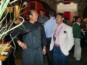
Iron Chefs Galore at CIA's Worlds of Flavor Conference


Most Recent Comments