
 List
List Map
Map Category
 Date
Date Popularity
 Tags
TagsIt's not every day that we get a news release datelined "Toppenish, WA" so you're going to hear about it.*
Very quickly in the story, though, we leave Toppenish for more exotic climes, as NOAA has tasked a high-altitude, twin-engine Gulfstream IV-SP jet to patrol the North Pacific Ocean this winter, and watch for winter storms developing there that will hit the continent (i.e., us) later on.
From now until February, the plane will be stationed at Yokota Air Force Base in Japan, then in March move to Honolulu. While aloft, it will "collect information such as wind speed and direction, pressure, temperature and humidity," which, fed by satellite to forecasting centers, should help modeling software develop more precise outcomes.
U.S. Senator Maria Cantwell, who is chair of the Oceans, Atmosphere, Fisheries, and Coast Guard Subcommittee, draws your attention to the benefit to Washington state:
Especially during this wet La Niña winter season, more accurate data on storms gathering off our coast is critical to our safety and livelihoods. Washington state is at the frontline of dangerous storms, and this plane’s high-tech capabilities will provide important supplemental data about any dangers approaching us. This winter season, residents, businesses and property are better protected with the help of this plane, which significantly improves forecasting of winter storms....
(more)
The Seattle branch of the National Weather Service (now on Facebook) was making dire predictions of a snow storm to arrive this week, but has since backed off the gas pedal, so far as accumulations go. Paul Deanno at KOMO is calling for two to four inches of snow to fall tomorrow afternoon, but that should get washed away overnight, as snow changes to rain.
Here's the revised, elliptical NWS prediction as of 9:20 a.m.:
THE NEXT...MUCH ANTICIPATED EVENT IS STILL UNFOLDING. WARM FRONTAL PRECIP WILL SPREAD NORTH INTO W WA TUE EVENING WHICH WILL LIKELY START OUT AS SNOW. NAILING THE SNOW TOTALS IS RATHER DIFFICULT AS WARMER AIR WILL CHANGE THE PRECIP TYPE OVER TO RAIN...SOMETIME LATE TUE NIGHT OR EARLY WED MORNING. THIS OUGHT TO MELT ANY ACCUMULATIONS. UNTIL THEN...MAY SEE WINTER WEATHER ADVISORY AMOUNTS IN THE LOWLANDS...
UW meteorologist Cliff Mass had been hoping for an historic snow event, but over the weekend, his hopes faded as models kept showing warmer air heading north, rather than south of us. (All we need is for that to change, and we're back in snowdrift country.) Now he's talking winds and heavy rains, none of which will help the condition of our streets. Look for that record number of potholes to increase.

Hopefully you're not planning on going anywhere the next few days. As CHS reminds you, King County Metro is providing reduced service all this week, before they jack you for an additional quarter at the fare box beginning next week. Here's their holiday bus service notice. So whether or not it snows and sticks mid-week, there's a good chance you'll be standing around in the cold for longer than usual, waiting for a bus to show.
Regarding that chance of snow, the National Weather Service has released this statement:
THERE IS A CHANCE OF HIT AND MISS LOWLAND SNOW FROM LATE TUESDAY NIGHT INTO THURSDAY MORNING. A DEEP UPPER TROUGH WILL SETTLE OVER WESTERN WASHINGTON BRINGING WITH IT COLDER TEMPERATURES AND SOME PRECIPITATION.
(Millions of dollars in sophisticated weather modeling equipment and they can't figure out how to work the Caps Lock key.) Be sure to check in again Tuesday morning to see how the NWS Seattle forecast is firming up. For now, they're claiming the precipitation will be "showery," which means it's more or less impossible to tell exactly which area might get how much snow. ...
 Why can't we handle snow? Let's start with why we can't read. Or why we choose to drive down the steepest, iciest hills in Seattle.
UW meteorologist Cliff Mass has a new post up promising "Perspective on the Winter So Far." Here's the conclusion, which may surprise some of you who believe the end-times are near:
Has this early winter been wacky and unusual? Not particularly. Pretty much every year there are storms and floods and daily records. Sign of global warming? No reason to think so.
Mass ticks off precipitation, temperature (average, highs and lows), snow pack, La Niña--it all averages out to be fairly normal. That doesn't mean nothing of note has happened; I think Mass's larger point is that winters, whether light or heavy, tend to bring us remarkable weather for the simple fact that people like to remark upon the weather doing something.
(On global warming, Mass always tries to direct people's attention away from weather to climate. Weather is statistically noisy.)
What I notice about recent winter weather is not the weather so much as our seeming inability to respond to any winter at all. A quick review of weather records reveals that the truly whopper snow storms and deep freezes dwarf anything I've seen the past 20 years. When we talk about terrible Seattle winters now, what we are really talking about is failures of our infrastructure, and the fact that few of us are even remotely prepared to go a few hours without power, heat, and access to transportation.
"Why can't we handle snow?" asked the Seattle Times, in the wake of our late-November few inches. People were "trapped" on I-5 for up to ten hours. Psychologically, that's more than long enough for people to lose their minds. Drivers ran out of gas, they had little food or water with them, and once gridlock set in, there was nowhere to go--not forward, not backward....

"Talking about rain... a LOT is coming starting Sunday, with the establishment of a significant pineapple express event," says UW meteorologist Cliff Mass. "And a super warm front." [UPDATE: "Atmospheric River."] His post is mainly about the squall line that blew through Wednesday morning, drenching the city, but the National Weather Service goes into a bit more detail.
From Saturday night through Monday, we should be experiencing a pineapple express weather system, which besides dumping a lot of rain on us, will raise the snow level to 7,000 feet--adding some snow melt to the rain-swollen rivers in the area. It's not clear yet from the models where the intensity of the rains will be strongest, so stay tuned.
KOMO's Paul Deanno says it could be the wettest storm in two years, adding that "if the rain goes for 24 hours or longer, we'll probably be dealing with flooding on the Nooksack, Skagit, Stillaguamish, Snoqualmie, Satsop and Bogachiel Rivers. If the rain keeps going, even the more stubborn-to-flood rivers like the Chehalis and Cowlitz could go over their banks." On the bright side, the NWS advises that the flood risk for the Green River is minimal.
 We're headed for a "very wet Monday afternoon" says KING 5's Rich Marriott, as a storm blows in with wind and rain. Up in the mountains that means snow, and if you're planning on a trip through the passes, consult with WSDOT first. Higher elevations are expected to get some six to twelve inches of snow from this storm.
Speaking of the weather, Cliff Mass is excited about two new ways you have to track weather online. There's a radar aggregator the UW has cooked up (that's where the screenshot comes from), and the kids in atmospherics have put together WINDWATCH, which...well, the name is fairly self-explanatory.
It's also timely, since this storm is expected to bring high winds just north of Seattle, and you can see what the models predict. Looks like the worst of it is supposed to come around 10 p.m. this evening.
 Looking west on E. John St.
Here's the latest street closures from SDOT:
- Northbound and southbound Alaskan Way Viaduct
- West Dravus Street between 20 and 27 Avenues
- Battery St. Tunnel
- NE 5100 block of Latona Ave. N
- Denny Way between Melrose and Stewart Sts.
I would just add that the streets are sheets of ice, and an hour ago I watched two cars do full 360s down Denny over I-5. They were creeping along, not speeding--it's just extremely slippery out there. SDOT will be out salting roads, but they warn that bridges and elevated structures require an abundance of caution. The storm is supposed to finish its snow-dumping work by 10 p.m., but the morning commute will still be ice-tastic. Less stressful photos after the jump:...
 Photo: Ryan Hawk/Woodland Park Zoo
(My apologies if you were in the mood for some brawny men building a snow fort.) The Woodland Park Zoo closed to the public at 3 p.m. today because of the snowy conditions, but that doesn't mean zoo residents had to huddle inside, too. The bears were putting those fur coats to good use.
 Our Flickr pool's shawnmebo is already back with snow day shots! That's fast!
UW meteorologist Cliff Mass has been putting out updates fast and furiously regarding the snow forecast for today, which is changing hourly as snow accumulates. Now he's concerned about "serious snow."
His latest post (titled "Humility") says we're pretty much guaranteed "2-4 inches south of the city, with roughly 1-2 inches on the north side. More as you head towards the Cascades and south." (Let's go to the radar!)
But looking at the way things are setting up, that might not be the worst in store:
The 11 AM surface map...just available shows a 1002-mb low over the NW tip of the Olympic Peninsula and the latest visible image show VERY unstable air offshore. If the low goes south of us and draws some of that cold, unstable air in...and it meets the cold stream from the north, we are talking about serious snow (6-12 inches).
Mass was earlier led astray by models which had the low farther south of Seattle, bringing us a blast of cold air but not much in the way of snow. ("Clearly, this was not a great success for the models--clearly more is getting farther north than forecast this morning.")
Might as well head home and fire up the hot chocolate, and wait to see what transpires.

"More than 150,000 homes in Western Washington are without power this morning," reports KOMO News, and provides a chart of last night's windstorm's peak gusts, ranging from 40 to 60 miles per hour. Sea-Tac registered a 49-mph blow. Constance, our literary editor and White Center weather correspondent, tells us that 5,000 people down there lost power for eight hours overnight, including Constance, who's sick at home with the flu.
The next storm arrives this Wednesday, says Paul Deanno. He and Cliff Mass agree--the mountains are going to get pounded with snow this weekend, but us lowlanders will get rained on. If you're planning on crossing the passes, be ready for a wild time. Models (so far) show most of the really cold air holing up in Canada for the weekend, with some sneaking over the border into northwestern Washington. Bellingham might get snow.
Mass is hesitant to speculate on snowfall in the Sound on Monday and Tuesday, though some models show just that. The convergence zone is a wily beast, and you never know quite where it's going to appear until you're almost on top of it. Stay tuned!
 Radar map image courtesy of the National Weather Service
As of Saturday, the UW's Cliff Mass was downgrading the risk of flooding even over the Olympics and North Cascades, because models were showing the rains passing through today, rather than setting up camp and pouring for several days.
That said, today's downpour is already well underway, and Seattle traffic maps are a motley of red and black. UW's Probcast gives us a 15 percent chance of more than an inch of rainfall (maximum 1.4 inches).
The massive low that's delivering this moisture is parked up in the Gulf of Alaska, and generating 30- to 40-foot waves out to sea.
That low is weakening, and tomorrow there's only a ten percent chance of rain. Again, looking out the window, that's a little hard to believe--but science says so. If you haven't voted, you won't be able to blame lousy weather for your lack of civic responsibility.
 Typhoon Chaba on Oct. 29 at 02:10 UTC (Photo: NASA Goddard MODIS Rapid Response Team)
Keeping life on the West coast interesting, Typhoon Chaba will be dressing up as a midlatitude cyclone for Halloween and will then "amplify into an extraordinarily deep low pressure center," says the UW's Cliff Mass. The result, for our purposes, is that we're going for a ride on the pineapple express. Says Mass:
I am sure the National Weather Service will be putting out some statements on potential flooding of rivers coming off the Olympics and N. Cascades. At this point it does not look like a situation that would produce urban flooding over the Puget Sound population areas.
We'll better know in a day or two how much rain Seattle will get, so keep an eye on UW's Probcast. And while you're doing that, it's a good time to announce that you can pick up your storm-drain "Fall Clean" supplies for free at Seattle Public Untility's warehouse (3633 East Marginal Way South) this Saturday, October 30, 9 a.m. to noon. That includes such goodies as: rakes, bags, gloves, shovels, brooms, and dustpans!
 Half Moon Bay getting hammered, as of this afternoon, courtesy of WestportCam
Thanks to 30-foot swells, the AP reports, "the Coast Guard has closed the Columbia River bar and most other entrances to coastal ports in Washington and Oregon." Cliff Mass notes that ocean buoys give readings of waves 40- to 45-feet in height. Says Mass, in a post titled, "Giant Waves":
This is really turning into an extraordinary event. I can't remember over many years seeing this situation...a very deep system, slowly dying, that is sitting right off our coast for days.
Let's go take a look! First up is Ocean Shores:
 Then we swing by La Push:
 ...
...
 Storm-watchers will be packing up and heading to the north coast this weekend, as a major low may bump right into us on Sunday. It's "what we call an extratropical cyclone in the business," reports Cliff Mass, with barely disguised anticipation.
You can watch an animated model here, but the short story is that if conditions are right (or wrong, depending on your perspective), the coast will get hit with sustained winds up to 45 knots, with 30- to 40-foot waves. That would likely bring power outages from downed trees and tree limbs, and attempts by surfers with poor risk/reward estimation to hit the beach.
Meanwhile, inland, all we get is a pretty good chance of showers on Saturday, increasing on Sunday. Mass explains why it doesn't look like we'll get in on the action:
I should note a rule of thumb of local meteorologists: to get strong winds over Puget Sound and the southern interior the low pressure center must cross the coast south of central Vancouver Island (my book has more on this).
 An inversion collects the smoke from the Jade Mine Road fire in a valley. (Photo: Ron Ewanyshyn, B.C. Wildfire Management)
Over 1,000 British Columbia firefighters are working on a startling 318 forest fires (map) throughout the province. Blame lightning. Numerous evacuation orders are in effect, and a water bomber crash claimed the lives of two men. Drifting to the south, over Seattle, the smoke's milky white haze has people reporting a red sky or golden sun. Of course Cliff Mass has satellite photos from MODIS.

I keep looking outside, since I was assured of a fine afternoon earlier by KOMO: "Thanks to a weak onshore flow encouraging the marine clouds to bunch up on into the Sound this morning, that's exactly what we'll enjoy today: patchy morning clouds, afternoon clearing, and highs in the low to middle 70s around the waterfront."
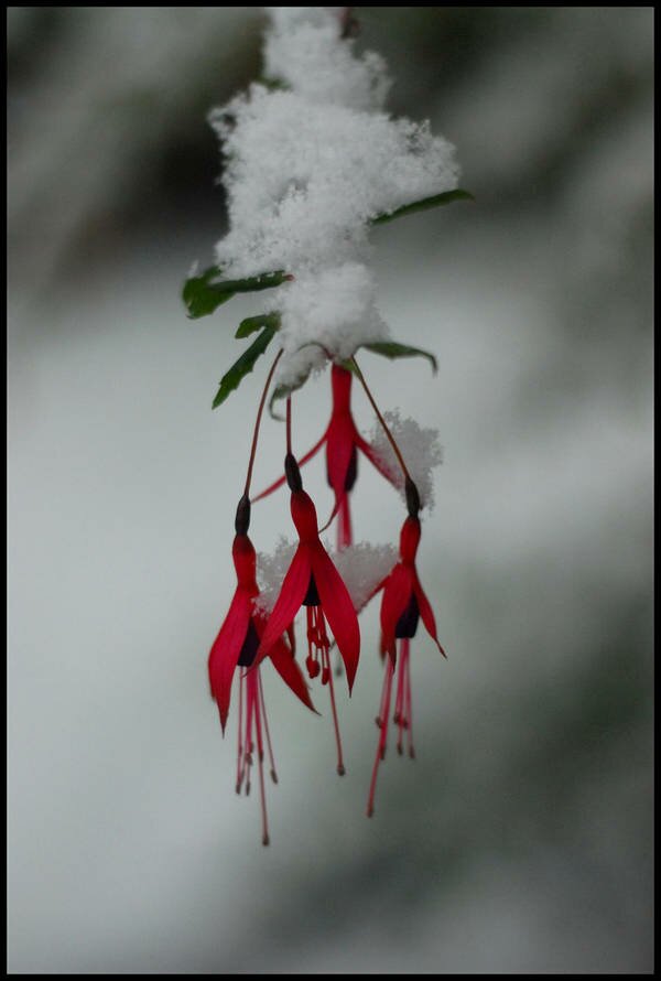
Can we get a sunbreak around here? In the meantime, please make do with this photo.
 Back to you in the studio!
 NOAA photo of NEXRAD installation
Our coastal radar system will be installed a year early, announced U.S. Senator Maria Cantwell yesterday. Chair of the Senate Oceans, Atmosphere, Fisheries, and Coast Guard Subcommittee, Cantwell had secured the millions of dollars necessary to build a new system, but this WSR-88D NEXRAD radar is coming to us from the Keesler Air Force Base in Mississippi. Apparently they weren't using it, and it was just sitting there.
"Although Washington bears the brunt of wintertime Pacific storms, our weather radar coverage has been shockingly inadequate, putting lives and property at risk," said Senator Cantwell in her announcement. "By acquiring this new radar technology and positioning the system west of the Cascades, Washingtonians can better prepare for the impact of the big Pacific storms on businesses and homes."
The radar will be sited out near Grays Harbor, with the site finalists announced this June.
"The top location is Langley Hill, located northwest of Hoquiam and about 3.5 miles east of Copalis Beach," writes University of Washington meteorologist Cliff Mass, a big proponent of coastal radar. He's especially pleased about the fact that it's a dual-polarization (polarimetric) radar that "sees" vertically and horizontally, which "allows identification of precipitation type and better estimation of rainfall intensity."
Mass expects weather forecasting in our area to make a major leap in accuracy once the radar is operational, as we'll have a much better view of Pacific storms heading our way, before they even make landfall.

First of all, if you're feeling a little out of sorts with the weather, it's not just you. And you can tell the "It's spring in Seattle, stupid, it's always like this" crowd that that's not true either. Cliff Mass has done the numbers and "For the past ten days the maximum temperature has stayed well below normal."
That said, buckle up, because there's more wet on the way. Tonight and tomorrow should bring a good soaking, we get Thursday off, and then Friday another storm seems to be shaping up that could bring strong winds as well as rain. I'll keep an eye on Cliff's blog and report back when he updates closer to the weekend. In the meantime, keep the galoshes handy, and be prepared to sprint outside on Thursday for sunbreaks.

Parts of Western Washington have already received over an inch of rain today, and a wetter week is forecast for the first week of June. Anchorage is currently 10 degrees warmer than Seattle. Forecasters agree that if we're going to have one good day this weekend, it'll be Sunday, so be prepared. In the meantime, here's a reminder that September can really nice.

I'm a little shell-shocked by the change in the weather. We went from this (above) as of 12:30 p.m., the deck at Azteca on Eastlake, to this (below), the Space Needle cam view of Lake Union as of 3 p.m. Here's KIRO 7 TV's interactive radar map, so you can see the front move through at neighborhood resolution.


I don't make these things up, people. This is exactly how these two tweets appeared in my general feed. Some people have the I Ching, I have random-but-meaningful combinations provided by Twitter.
In the unlikely event of summer arriving, I give you the link to that Red Cross Babysitter's class. In the hopefully unlikely event that your power goes out, I give you Seattle City Light's instructions on how to live through it.
My personal advice, as always, is to seek shelter at any establishment with a good happy hour and a strong scotch or bourbon selection, and let someone else take care of the lights.

The National Weather Service has a wind advisory out for the Seattle area, in effect from 1 p.m. today until midnight:
LIGHT NORTHEAST WINDS ACROSS THE REGION THIS MORNING WILL SHIFT TO SOUTHERLY MIDDAY AND RISE QUICKLY DURING THE EARLY AFTERNOON...WITH LOCAL WINDS OF 30 MPH AND GUSTS TO 45 MPH CONTINUING THROUGH LATE EVENING. THE WINDS WILL EASE AFTER MIDNIGHT.
It's a little disconcerting, the all-caps format from the NWS, isn't it? You can almost hear the Telex chattering as they stare into a monochrome CRT monitor. Anyway, expect wind, cooling temperatures, and some rain in your face as the afternoon progresses.
Cliff Mass has been watching this storm's development--it's primarily aimed at the coast, and models show an even stronger storm on the way than forecasted yesterday:
Here is the latest forecast for 5 PM tonight...pretty amazing. 989 mb low and a huge pressure gradient to its south and southeast. The simulation indicates even stronger winds than last night, with areas immediately offshore experiencing 60 kt sustained winds and hurricane-force gusts.
Yesterday he explained the wind-generating dynamics. While the low moving in doesn't pack the punch of a winter storm, our springtime "environmental pressure" is high, so there's a big differential between the two air masses. That, friends, means wind with a capital W! The coast will most likely see power outages--and we could see local outages, too, from small trees or big branches.
 It's all seadevi all day on The SunBreak! Who can take a photo of the wind? seadevi can!
Power outages have already begun (the Rainier Beach outage is already fixed), thanks to high winds. On the eastern side of the state, the National Weather Service warns of dust storms (which can sometimes be big enough to be seen from space--visibility is terrible while you're in one). For the Puget Sound, we've got a wind advisory until about 7 p.m., which means winds from 20-30 mph, with gusts up to 50. Here's Seattle City Light's "When the power goes out" page.
The Seattle Red Cross says stay safe, and be prepared with this list of tips:
Prepare for High Winds
- Move or secure lawn furniture, outdoor decorations or ornaments, trash cans, hanging plants and anything else that can be picked up by wind and become a projectile.
- During the storm, draw blinds and shades over windows. If windows break due to objects blown by the wind, the shades will prevent glass from shattering into your home. ...
Hello!
Twitter: @thesunbreak | Facebook
iPhone app download (Free!)
Subscribe to The SunBreak
Delivery Options
 Subscribe to our Front Page Stories
Subscribe to all SunBreak Stories
Daily Email Digest of The SunBreak
Most Viewed Stories
Latest Headlines
- Taproot Theatre's "The Oddyssey" Is a Thoughtful (and Traditional) Treatment of a Classic
- BREAKING: Intiman Theater Needs $500K By End of March to Keep Doors Open
- Zoo Gets in the Valentine's Day Spirit
- Choreographer Amy O'Neal Gives Us the Lowdown on "The Lowdown," Tonight at the Moore
- Town Hall Community Fund Wants to Subsidize Your Project
Recently in Our Flickr Photo Pool
www.flickr.com
|
Our Facebook Fan Page
Neighborhood Blog News
Niche Blog News
Seattle Weather
Get the SunBreak iPhone App
Download the SunBreak iPhone app for free.

Most Recent Comments