Recent Stories with tag snow
|

 List
List Map
Map Category
 Date
Date Popularity
 Tags
Tags
Our Whidbey Island correspondent provides this winter wonderland view, confirming this Seattlepi.com story, "Whidbey Island faces snow days." Islanders are expecting between "1 and 3 inches of snow" to accumulate today, with perhaps another inch coming Thursday.
Here in Seattle, roadways are mostly bare and wet--after graupel yesterday and some wet snow for the commute home, we're in a snow shadow cast by the Olympics. In this morning's post, the UW's Cliff Mass suggests that while snow is on the way, at least today it won't be cold enough to freeze during the afternoon commute:
The models indicate that during the day the flow approaching the region will weaken and turn more southerly....that will open Seattle to snow showers, and as the low moves south, northerly flow will push southward. But not yet. Last night the NWS was going for a hard freeze of this stuff later today during the commute home. Looking at the situation now I believe that is highly unlikely....
(more)

Last Friday, the UW's Cliff Mass was running the models and snow kept popping up: "The model forecasts for next Wednesday and Thursday would warm the heart of a polar bear. You want a high amplitude trough, well positioned to bring in cold air...you got it."
But the models have forecast snow before, and the key elements have skittered around enough in the intervening days that nothing much has appeared. "I won't get too excited about this until Monday," wrote Mass.
Now it's Monday, and KOMO's Scott Sistek sounds pretty confident in flakes for the week ahead: "Snow chances begin as early as Monday night, but low elevation areas don't really have potential to see any accumulations until at least Tuesday or Wednesday."
Tuesday there'll likely be a convergence zone playing impishly with where winter weather appears in force, but, says Sistek, "Wednesday midday through Thursday morning is our best chance of lowland snow of the week, with greatest chances for getting snow and accumulations north of Seattle." Here's the updated National Weather Service forecast for the week, also picking on Wednesday as a good snow day: ...
The Seattle branch of the National Weather Service (now on Facebook) was making dire predictions of a snow storm to arrive this week, but has since backed off the gas pedal, so far as accumulations go. Paul Deanno at KOMO is calling for two to four inches of snow to fall tomorrow afternoon, but that should get washed away overnight, as snow changes to rain.
Here's the revised, elliptical NWS prediction as of 9:20 a.m.:
THE NEXT...MUCH ANTICIPATED EVENT IS STILL UNFOLDING. WARM FRONTAL PRECIP WILL SPREAD NORTH INTO W WA TUE EVENING WHICH WILL LIKELY START OUT AS SNOW. NAILING THE SNOW TOTALS IS RATHER DIFFICULT AS WARMER AIR WILL CHANGE THE PRECIP TYPE OVER TO RAIN...SOMETIME LATE TUE NIGHT OR EARLY WED MORNING. THIS OUGHT TO MELT ANY ACCUMULATIONS. UNTIL THEN...MAY SEE WINTER WEATHER ADVISORY AMOUNTS IN THE LOWLANDS...
UW meteorologist Cliff Mass had been hoping for an historic snow event, but over the weekend, his hopes faded as models kept showing warmer air heading north, rather than south of us. (All we need is for that to change, and we're back in snowdrift country.) Now he's talking winds and heavy rains, none of which will help the condition of our streets. Look for that record number of potholes to increase.
Our Flickr pool's Great Beyond has a whole series of photos of snowstorms of the '70s that bring back Seattle's workingman past in a Kodachrome rush. Here we are at the corner of 15th Avenue East and Republican Street on Capitol Hill, in November 1979. There's a Spic 'n' Span Cleaners where Caffe Ladro is today, and you can almost feel the snow crunch underfoot. We are not supposed to get that much snow this weekend, if any at all, and Kodachrome's power to color saturate your life has come to an end.
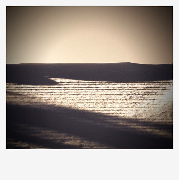
Seattle has so far escaped the clutches of the Puget Sound Convergence Zone this morning; UW meteorologist Cliff Mass has a post up on the hit-and-miss nature of the snowfall, which is whitening Lynnwood to Everett. That being the case, here's some snow anyway, courtesy of shawnmebo and our Flickr pool. It's a gorgeous shot, thanks to the play of light and shadow, and soft and hard outlines.

Hopefully you're not planning on going anywhere the next few days. As CHS reminds you, King County Metro is providing reduced service all this week, before they jack you for an additional quarter at the fare box beginning next week. Here's their holiday bus service notice. So whether or not it snows and sticks mid-week, there's a good chance you'll be standing around in the cold for longer than usual, waiting for a bus to show.
Regarding that chance of snow, the National Weather Service has released this statement:
THERE IS A CHANCE OF HIT AND MISS LOWLAND SNOW FROM LATE TUESDAY NIGHT INTO THURSDAY MORNING. A DEEP UPPER TROUGH WILL SETTLE OVER WESTERN WASHINGTON BRINGING WITH IT COLDER TEMPERATURES AND SOME PRECIPITATION.
(Millions of dollars in sophisticated weather modeling equipment and they can't figure out how to work the Caps Lock key.) Be sure to check in again Tuesday morning to see how the NWS Seattle forecast is firming up. For now, they're claiming the precipitation will be "showery," which means it's more or less impossible to tell exactly which area might get how much snow. ...
 Why can't we handle snow? Let's start with why we can't read. Or why we choose to drive down the steepest, iciest hills in Seattle.
UW meteorologist Cliff Mass has a new post up promising "Perspective on the Winter So Far." Here's the conclusion, which may surprise some of you who believe the end-times are near:
Has this early winter been wacky and unusual? Not particularly. Pretty much every year there are storms and floods and daily records. Sign of global warming? No reason to think so.
Mass ticks off precipitation, temperature (average, highs and lows), snow pack, La Niña--it all averages out to be fairly normal. That doesn't mean nothing of note has happened; I think Mass's larger point is that winters, whether light or heavy, tend to bring us remarkable weather for the simple fact that people like to remark upon the weather doing something.
(On global warming, Mass always tries to direct people's attention away from weather to climate. Weather is statistically noisy.)
What I notice about recent winter weather is not the weather so much as our seeming inability to respond to any winter at all. A quick review of weather records reveals that the truly whopper snow storms and deep freezes dwarf anything I've seen the past 20 years. When we talk about terrible Seattle winters now, what we are really talking about is failures of our infrastructure, and the fact that few of us are even remotely prepared to go a few hours without power, heat, and access to transportation.
"Why can't we handle snow?" asked the Seattle Times, in the wake of our late-November few inches. People were "trapped" on I-5 for up to ten hours. Psychologically, that's more than long enough for people to lose their minds. Drivers ran out of gas, they had little food or water with them, and once gridlock set in, there was nowhere to go--not forward, not backward....
 We're headed for a "very wet Monday afternoon" says KING 5's Rich Marriott, as a storm blows in with wind and rain. Up in the mountains that means snow, and if you're planning on a trip through the passes, consult with WSDOT first. Higher elevations are expected to get some six to twelve inches of snow from this storm.
Speaking of the weather, Cliff Mass is excited about two new ways you have to track weather online. There's a radar aggregator the UW has cooked up (that's where the screenshot comes from), and the kids in atmospherics have put together WINDWATCH, which...well, the name is fairly self-explanatory.
It's also timely, since this storm is expected to bring high winds just north of Seattle, and you can see what the models predict. Looks like the worst of it is supposed to come around 10 p.m. this evening.
And now a video preview of what you're likely to see tonight, once the roads ice back up. People, charge your cameras! If you're driving, a safety tip: Avoid really steep hills.
...
Our Flickr pool's Chris Blakeley came across this SUV "abandoned maybe fifteen feet away from the top of Queen Anne." Other drivers weren't so lucky.
 Looking west on E. John St.
Here's the latest street closures from SDOT:
- Northbound and southbound Alaskan Way Viaduct
- West Dravus Street between 20 and 27 Avenues
- Battery St. Tunnel
- NE 5100 block of Latona Ave. N
- Denny Way between Melrose and Stewart Sts.
I would just add that the streets are sheets of ice, and an hour ago I watched two cars do full 360s down Denny over I-5. They were creeping along, not speeding--it's just extremely slippery out there. SDOT will be out salting roads, but they warn that bridges and elevated structures require an abundance of caution. The storm is supposed to finish its snow-dumping work by 10 p.m., but the morning commute will still be ice-tastic. Less stressful photos after the jump:...
 Photo: Ryan Hawk/Woodland Park Zoo
(My apologies if you were in the mood for some brawny men building a snow fort.) The Woodland Park Zoo closed to the public at 3 p.m. today because of the snowy conditions, but that doesn't mean zoo residents had to huddle inside, too. The bears were putting those fur coats to good use.
 Our Flickr pool's shawnmebo is already back with snow day shots! That's fast!
UW meteorologist Cliff Mass has been putting out updates fast and furiously regarding the snow forecast for today, which is changing hourly as snow accumulates. Now he's concerned about "serious snow."
His latest post (titled "Humility") says we're pretty much guaranteed "2-4 inches south of the city, with roughly 1-2 inches on the north side. More as you head towards the Cascades and south." (Let's go to the radar!)
But looking at the way things are setting up, that might not be the worst in store:
The 11 AM surface map...just available shows a 1002-mb low over the NW tip of the Olympic Peninsula and the latest visible image show VERY unstable air offshore. If the low goes south of us and draws some of that cold, unstable air in...and it meets the cold stream from the north, we are talking about serious snow (6-12 inches).
Mass was earlier led astray by models which had the low farther south of Seattle, bringing us a blast of cold air but not much in the way of snow. ("Clearly, this was not a great success for the models--clearly more is getting farther north than forecast this morning.")
Might as well head home and fire up the hot chocolate, and wait to see what transpires.
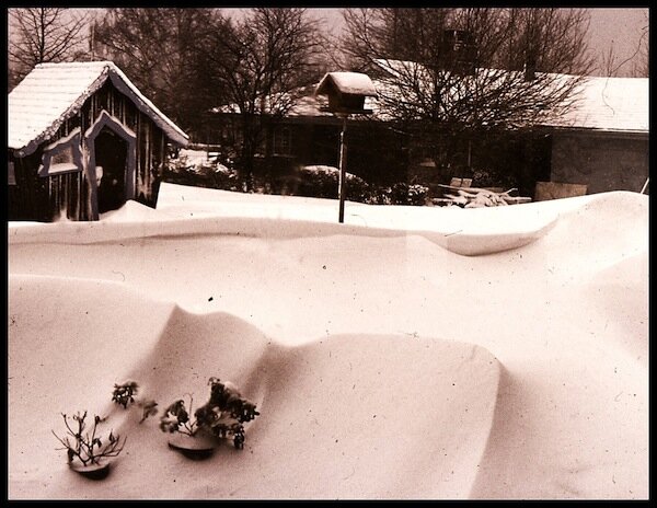
1972 "was a bad year if you hate snow," writes our Flickr pool's shawnmebo. "Let's see what Steve Pool has to say about it." Today a bunch of Canadian cold air heads our way, bringing lots of snow in the mountains. Cliff Mass waves off concerns of Snowpocalypse 2010...mostly, noting that tomorrow we see something "close to a pattern that brings snow...but the models are emphatic that it is too warm over most of the lowlands for snow. The freezing level is at around 2000 ft and the snow level is around 1000 ft. This is close."

"More than 150,000 homes in Western Washington are without power this morning," reports KOMO News, and provides a chart of last night's windstorm's peak gusts, ranging from 40 to 60 miles per hour. Sea-Tac registered a 49-mph blow. Constance, our literary editor and White Center weather correspondent, tells us that 5,000 people down there lost power for eight hours overnight, including Constance, who's sick at home with the flu.
The next storm arrives this Wednesday, says Paul Deanno. He and Cliff Mass agree--the mountains are going to get pounded with snow this weekend, but us lowlanders will get rained on. If you're planning on crossing the passes, be ready for a wild time. Models (so far) show most of the really cold air holing up in Canada for the weekend, with some sneaking over the border into northwestern Washington. Bellingham might get snow.
Mass is hesitant to speculate on snowfall in the Sound on Monday and Tuesday, though some models show just that. The convergence zone is a wily beast, and you never know quite where it's going to appear until you're almost on top of it. Stay tuned!
While announcing the good news about Standard & Poor's improved bond rating for Seattle City Light, Mayor McGinn added something that surprised me.
"Maintaining an AA- bond rating is essential for Seattle City Light to continue providing excellent service for residents of our city," he said. "But we aren’t out of the woods yet. Seattle City Light is facing serious challenges, including a shortfall in revenues due to a far below average snowpack."
 Local weather media had given me the impression our series of late spring storms had brought the snowpack back close to normal. That would be good news, because a plentiful snowpack means lots of hydropower throughout the summer, and hydropower is cheap electricity. (If extra is generated, City Light sells it and pockets the cash and we all win.)
But not so fast--our snowpack is still feeble, even with snow piled high. The confusion partly depends on what you mean by "snowpack."
"It simply isn't true," sighed City Light's communications director Suzanne Hartman, when I asked if the storms had made much of a difference. This late in the season, the snow that falls doesn't have time to consolidate into a harder, compressed mass that acts as a cold "battery" in warmer months. Plus, snowpack isn't measured simply by inches of snow, but by the "snow-water equivalent"--a dry powder is great for skiing, but it doesn't represent that much water.

As the graph shows, while precipitation was up, the snow-water equivalent differs. Ultimately, Hartman says, the storms resulted in a change (for the good) of about five percent overall, between City Light's Pend Oreille and Skagit River Valley basin measurements. And the melt has already begun. Both areas lost almost three inches of snow-water equivalent last week.
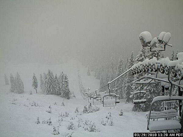 Courtesy of KIRO TV's Wildside, Summit West web cam.
I guess this counts as going out like a lion. The National Weather Service has issued a winter storm warning for Washington's Olympics and Cascades:
A STRONG FRONTAL SYSTEM WILL BRING HEAVY SNOW TO THE MOUNTAINS TODAY AND TONIGHT. AFTER THE FRONT MOVES EAST THIS MORNING...STRONG SOUTHWEST FLOW ALOFT WILL BRING MORE HEAVY SNOW...AND THE SNOW LEVEL WILL FALL BELOW 3000 FEET THIS AFTERNOON. SNOWFALL WILL DECREASE BY TUESDAY MORNING AS THE FLOW ALOFT WEAKENS.
Accumulations could reach a foot through today, with almost as much dropping again overnight. Mount Baker should see significant snowfall. The web cams at White Pass and Alpental bear out the prediction. That's great news for skiers and snowboarders, but it's also bringing avalanche warnings, so back country daredevils: take a pass. Check in on WSDOT's mountain passes page to see if avalanche control is going to bring any traffic delays the next few days.
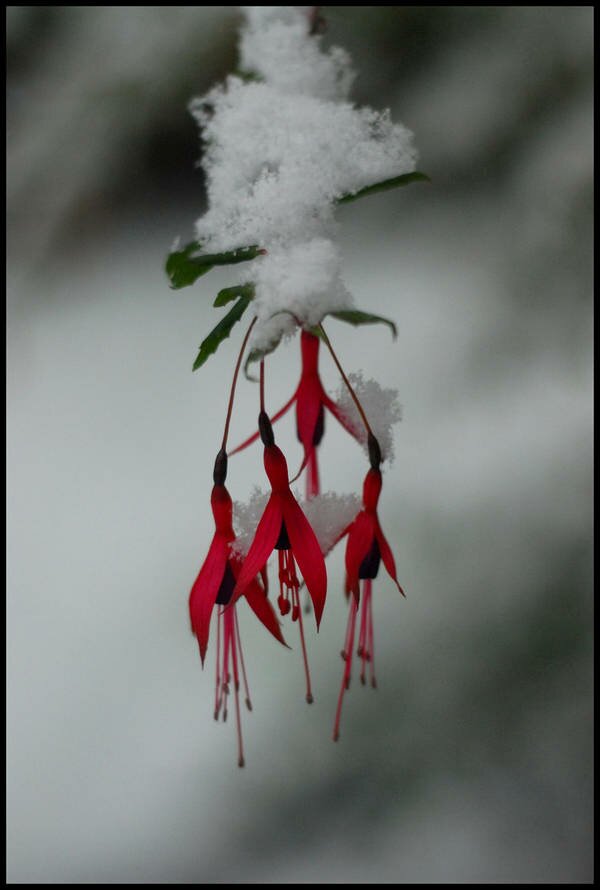
 A late February snow from 2009.
Some cold and wet is sneaking past our nice El Niño pre-spring this week. Cliff Mass says it'll bring snow in the mountains by tonight and through the early part of the week. Depending upon the mysterious workings of our Puget Sound convergence zone, lowland areas may see snow showers on Monday morning and Tuesday. Later in the week, temperatures will pop back up a bit, but it's going to be more like real March weather out there.

The Vancouver Olympic Games are "snow-challenged," thanks to an El Nino weather pattern that's sluiced away sixteen inches of snow from Cypress Mountain since January 1. In Seattle, El Nino has resulted in great, atmosphere-magnified views of the surrounding mountainscapes in all directions.
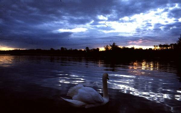 "Swan on Lake Washington 1987" comes with a story from shawnmebo: "This swan was mean as hell. He had a bad habit of attacking people. People with dogs. Let's just say it didn't end well for him."
After a week of icy temperatures and steam fog, things meteorological are finally warming up...to snow. Cliff Mass says "not a lot" of snow is expected Sunday, but "enough to whiten the place." No matter how much we get, it should melt off when temperatures rise to the 40s next week. Still, to be on the safe side, now is a good time to start following Metro's crowd-sourced snow reports on Twitter.
You may not believe this--that's where FlightBlogger's video will come in handy--but Boeing has been taxi testing its 787 Dreamliner this morning. Here's a picture of the 787 moving under its own steam. Brakes look good.
Earlier in the week, Elliott Bay Book Company officially announced its move to Capitol Hill, with a spring opening planned. The Seattle Times took a sneak peek at the new digs. What'll be new: 85 parking spaces associated with the building, central heating, and--if they turn a profit--streaming videos of their author readings. There's also talk of a café "likely" run by Brasa's Tamara Murphy, which may create an indie café singularity in the Pike-Pine neighborhood.
In other local bidness news, Birgitta is having a going-outta-business sale this weekend, and Google informed us that our sponsor Central Cinema is one of Seattle's favorite places.
In the ghost-of-local-news-past category, there are questions about WaMu's seizure that just won't go away. The FDIC says Horizon Bank, Evergreen, and Rainier Pacific are all under-capitalized. Seattle Bubble also noted that Seattle's November foreclosures were up 45 percent from last year....
Let's see, we've done Snowpocalypse and Snowmageddon. What's next? Whatever it is, SDOT is gearing up to handle it. Besides showing off their new operations room in the above video, they are explaining winter to you on their blog. "Seattle is not Snoqualmie Pass!"
There's also a pdf of a Snow Map, which includes Seattle's snow and ice routes, lists important telephone numbers and web sites, and offers preparedness tips. I know many of you would like to offer SDOT preparedness tips of your own, but please be patient! The map may turn out to be useful because, as West Seattle Blog reports, SDOT is committing to "bare pavement" on certain routes.
Here is something I can't stress enough: "Property owners, both in residential and business areas, are responsible for shoveling their sidewalks and steps." However badly SDOT stumbled in handling the snow last year, we, the Seattle citizens, were worse about keeping sidewalks clear. Many never bothered to make a stab at it, despite my glances of disapproval. This...
Most Viewed Stories
-
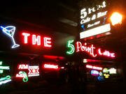
Belltown NIMBYs Have a Problem With This Upstart "5 Point" Place
- From the Publisher's Couch: The SunBreak's Progress, Chapter Two
- Watch This Space! Live from New York, It's Spectrum Dance Theater
- The Weekend Wrap: Neighborhood Headline News Feb. 20 - 26
- "The New New News" Illustrates Hybrid Vigor of News-Theatre


Most Recent Comments